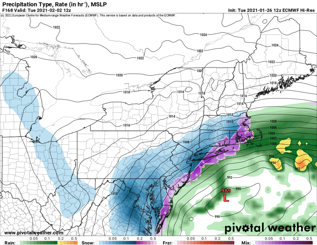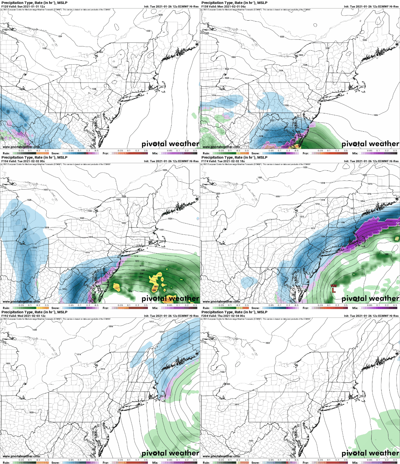
The European ECMWF forecast model is suggesting wintry weather for portions of the Mid Atlantic and Northeast this weekend, with a snowstorm forecast to develop on Sunday in the east. Whether the model comes to fruition remains to be seen.
While meteorologists have many tools at their disposal to create weather forecasts, two primary global forecast models they do use are the ECMWF from Europe and the GFS from the United States. While the models share a lot of the same initial data, they differ with how they digest that data and compute possible outcomes. One is better than the other in some scenarios, while the opposite is true in others. No model is “right” all the time. Beyond the ECMWF and GFS models, there are numerous other models from other countries, other academic institutions, and private industry that are also considered when making a forecast.
For the Sunday storm, the ECMWF model is an outlier with the other global models. While the ECMWF suggests a storm will take place, other models aren’t nearly as impressive. However, while other models like the American GFS were more robust with today’s and Thursday/Friday’s storm system, the ECMWF was more accurate in depicting what happened / what will likely happen this week with these storms. Whether or not that accuracy extends into the weekend remains to be seen.

The European model shows the area of low pressure responsible for blizzard conditions in the western U.S. tonight moving across the country with time. By Sunday evening, the area of low pressure is over Kentucky as snow breaks out in portions of the Ohio River Valley and the Mid Atlantic near Virginia and Maryland. By midnight Sunday night, the ECMWF shows a stronger coastal low redeveloping in this system over the North Carolina coast. Meanwhile, snow expands north into Pennsylvania. On Monday, the coastal storm creeps northward, dumping very heavy snow over Virginia while expanding the field of snow north into Delaware, New Jersey, and the New York City metro area. By Tuesday afternoon, the ECMWF shows the center of the storm slowly moving to the north and east. Centered east of the Maryland coast by Tuesday afternoon, accumulating snow spreads from Virginia to southern New Hampshire and Maine. Because of how far the storm center is off the coast, snow would fall all the way to the ocean by Tuesday evening in Delaware, New Jersey, New York, and Rhode Island. By Wednesday afternoon, the slow moving storm would be centered south of Nova Scotia. There, it would continue to bring snow to Maine, New Hampshire, and coastal Massachusetts.
If this run of the ECMWF forecast model were to be right, it would mean heavy snow from Virginia to Maine with extremely heavy snow over central Virginia. It suggests more than 2-2.5 feet of snow could fall there while a widespread 6-12″ would fall across Delaware, New Jersey, the New York City metro area, and much of southern and coastal New England.
But if the ECMWF is right is a big “if”; because none of the other global forecast models suggest such a scenario, and this latest ECMWF run is more severe than earlier runs, confidence is low now that a storm would evolve as modeled.
In contrast, the American GFS also has an area of low pressure from the U.S. West marching east, but it intensifies it into a Great Lakes storm rather than a coastal one. While coastal redevelopment does eventually occur with the American forecast model, it limits significant measurable snow to areas north of New York City by Monday. While the European model suggests heavy snow for places like Virginia, the American model depicts mainly heavy rain there.
Meteorologists will know better how things will evolve as the west coast system impacts the west. The atmospheric river event will unfold this evening and linger for 24 hours in the Rockies. As data from that storm and its actual impacts become known, meteorologists and the models they use will have a better idea of how this storm system will progress across the country …and what impacts to the East Coast will be in time.