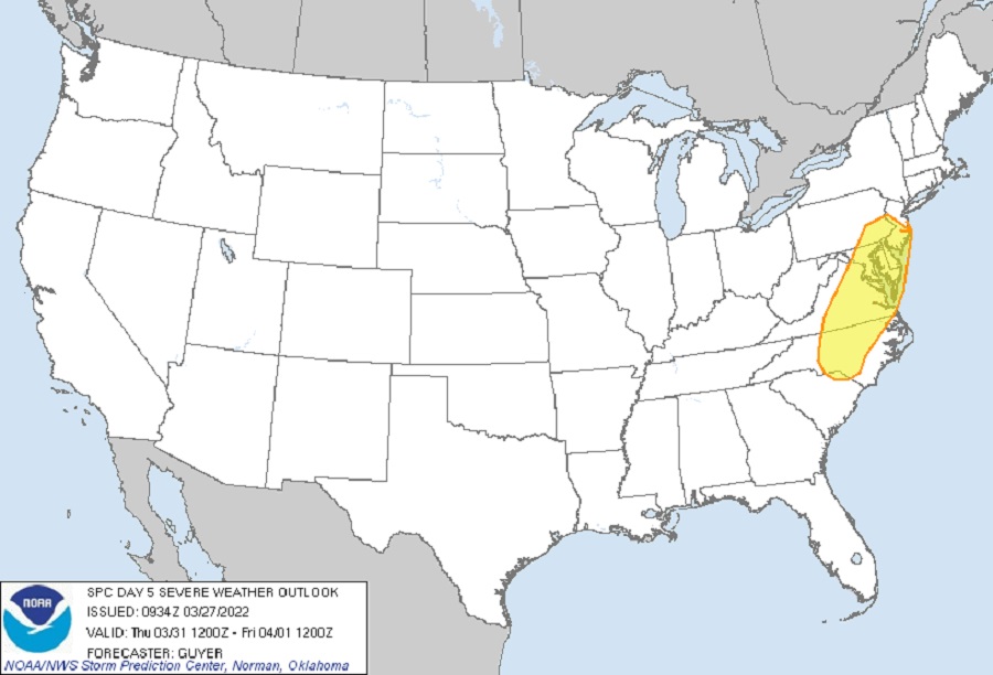
For the first time since records began in 2009, the National Weather Service’s Storm Prediction Center has issued a Convective Outlook that shows the potential for a severe weather outbreak in portions of New Jersey, Pennsylvania, Delaware, Maryland, Virginia, and North Carolina on Thursday. Due to lack of confidence in forecast data or due to too many unknowns with outbreak severity, the Storm Prediction Center rarely issues outlooks beyond Day 4; the fact they’ve issued a Day 5 outlook for portions of the Mid Atlantic in March is quite exceptional.
The Day 5 danger zone covers an area of 72,902 square miles which contains a population of 27,058,632 people. Included in the zone are the cities of Philadelphia, PA, Baltimore, MD, Washington, DC, Virginia Beach, VA, and Raleigh, NC.
Over a 2-day severe weather outbreak that starts in the middle of the country on Wednesday, the Storm Prediction Center believes there could be widespread damaging winds and tornadoes, including the possibility of isolated strong (EF 2+) tornadoes as the severe weather system takes shape.
According to the Storm Prediction Center, on Wednesday, an increasingly moist air mass is expected across the middle of the U.S. ahead of an upper-level trough that will take on an increasingly negative tilt, with very strong deep-layer/low-level winds coincident with a modestly unstable air mass. “The extremely strong wind fields are concerning for the potential for long-lived supercells/fast-moving bowing segments where modest destabilization does occur,” the SPC said in a Convective Outlook released today. “The most concerning severe-favorable ingredients currently appear most probable across sizable portions of Louisiana, Mississippi, and Alabama.”

On Thursday, that disturbance will push east, bringing the severe weather threat to portions of the Mid Atlantic. The Storm Prediction Center warns that the potential exists for fast-moving, low-topped storms capable of wind damage.
Meteorologists at the National Weather Service in Mount Holly, New Jersey expressed concern with the severe weather threat for Thursday in their latest Forecast Discussion issued today. “Given the strong forcing arriving from the west with an incoming cold front later in the afternoon, a low-topped squall line may develop and race across much of our area later in the afternoon and evening. Given the wind profiles, locally strong to damaging winds may occur especially with associated line segments that may take on some bowing/surging,” the New Jersey-based office of the National Weather Service said about their forecast area which includes portions of New Jersey, Pennsylvania, Maryland, and Delaware. “The severe weather risk will depend on the timing and also the amount of instability, however as of now, plenty of shear is forecast along with strong forcing.”
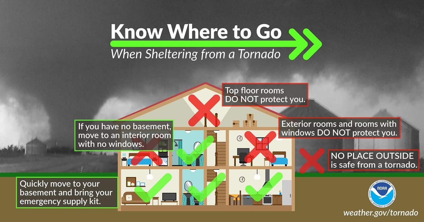
Fortunately, there are many days for meteorologists to refine their severe weather forecasts while residents have ample time to make preparations too. Loose outdoor objects should be secured; preparations for the possibility of power outages should also be taken in advance of Thursday’s severe weather. People in the risk area should know how to get any Severe Thunderstorm Warning or Tornado Warning messages from the National Weather Service and know what to do should such a warning be issued for their county and community.