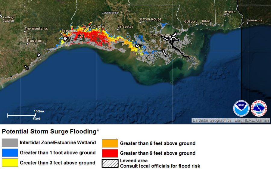
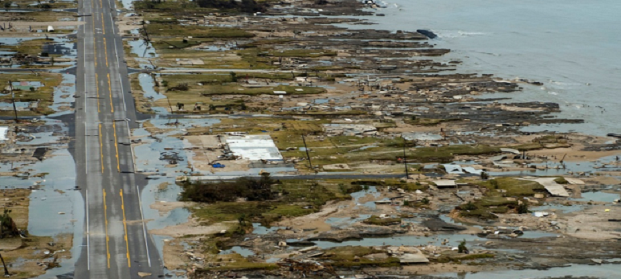
An extreme storm surge that the National Hurricane Center has described as “unsurvivable” is expected to sweep across portions of the Gulf Coast later tonight, erasing many communities off the map. As high as 15-20 feet, the storm surge will extend far away from the coast in portions of Texas and Louisiana, in some cases reaching beyond 30 miles from the Gulf Coast. Topped with extreme waves that could be dozens of feet tall, the power associated with storm surge is strong enough to scrub all man made structures off of the ground.
The combination of a dangerous storm surge and the tide will cause normally dry areas near the coast to be flooded by rising waters moving inland from the shoreline. Due to this nearly imminent threat, the National Hurricane Center has Storm Surge Warnings and Watches up along the coast. Storm surge and tropical-storm-force winds will arrive within the warning areas well in advance of Laura’s center; because of Laura’s size, storm surge will impact regions far away from the eye and where the center will cross land.
“All preparations to protect life and property should be rushed to completion in the next few hours,” the National Hurricane Center warns.
The deepest water will occur along the immediate coast near and to the right of the landfall location, where the surge will be accompanied by large and destructive waves.
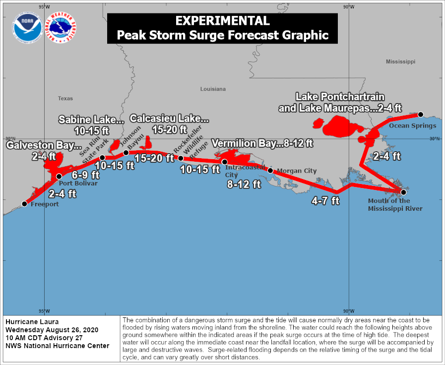
“Unsurvivable storm surge with large and destructive waves will cause catastrophic damage from Sea Rim State Park, Texas, to Intracoastal City, Louisiana, including Calcasieu and Sabine Lakes. This storm surge could penetrate up to 30 miles inland from the immediate coastline in southwestern Louisiana and far southeastern Texas,” warns the National Hurricane Center in their latest advisory on Hurricane Laura.
Surge-related flooding depends on the relative timing of the surge and the tidal cycle, and can vary greatly over short distances. Unfortunately, it appears Hurricane Laura will make landfall near a time of high tide with will exacerbate the flood threat.
