February 2021 is kicking off with the continuing winter storm along the U.S. East Coast as January ends without too much winter storm activity in the region. The most significant snowstorm of the season, and perhaps one of the most significant snowstorms in recent years, continues to unfold in the northeast, bringing heavy snow to a wide area.
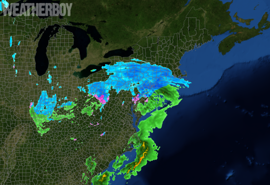
Low pressure that was in the upper Ohio Valley yesterday afternoon is transferring energy to a new low that continues to develop and strengthen off of the Mid-Atlantic coast. Becoming the primary storm center, this area of low pressure will slowly creep up the Jersey Shore and into southeastern New England tomorrow before entering the Canadian Maritimes on Wednesday. As it slowly moves up the coast, areas that saw rain will see precipitation change back to snow as far south as Maryland and northeastern Virginia. Snow in southeastern New England will change to rain during the day today, and back to snow as the system exits later tomorrow night into Wednesday.

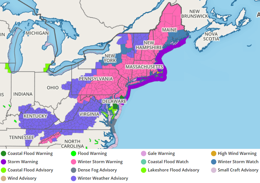
With severe winter weather conditions persisting, the National Weather Service is maintaining Winter Storm Warnings from northern Maryland and Delaware and southern New Jersey north to Maine, including the cities of Philadelphia, New York, Hartford, Providence, Boston, and Portsmouth. Advisories for slight to moderate coastal flooding is also up along portions of the Mid Atlantic and Northeast coast. Strong winds may also create problems, especially over far eastern Long Island and southeastern New England as the storm slides up the coast. Because of that, the National Weather Service has wind-related advisories and warnings up too.
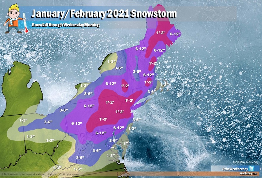
When this multi-day storm system is done by Wednesday, some will see snow totals of 1-2 feet.
