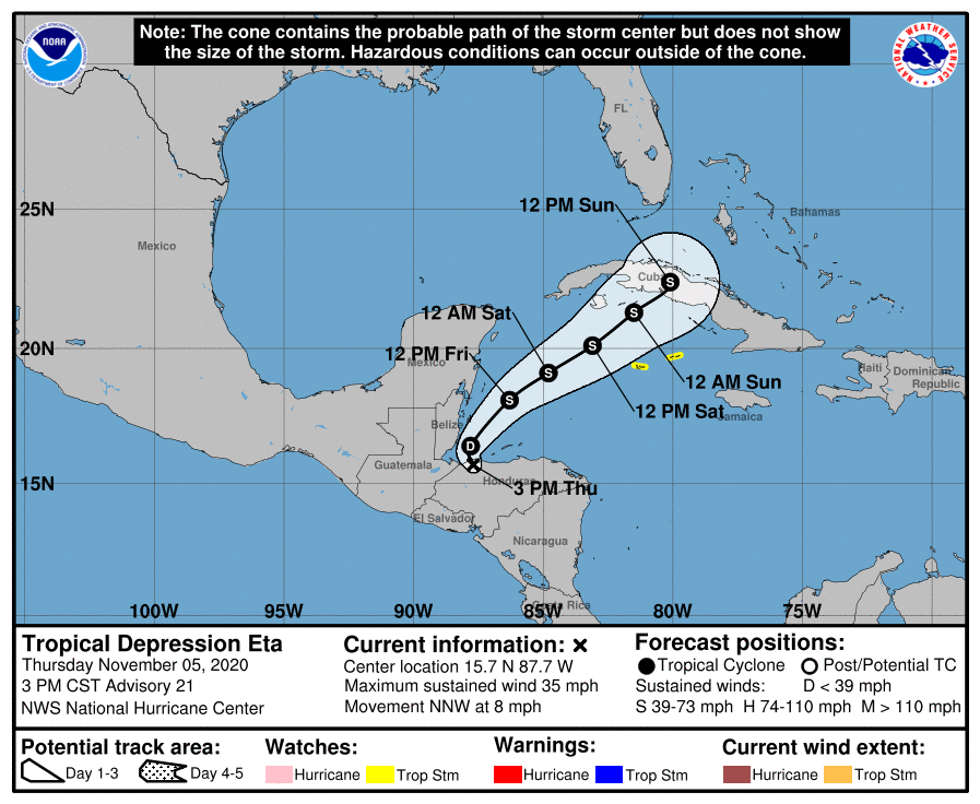
Eta, now as a tropical depression, continues to dump heavy rains and cause life-threatening flooding over portions of Central America today; by as soon as this weekend, Florida may see some of that heavy rain. According to the National Hurricane Center (NHC) in Miami, Florida, the center of Eta was located about 60 miles west of La Ceiba, Honduras; it should move over the northwestern Caribbean during the next 6-12 hours. Eventually, it could head for a final landfall on the U.S. coast.
Many questions remain with how strong Eta will become and where it’ll go with time. Right now, Eta has maximum sustained winds of only 35 mph and a minimum central pressure of 1005 mb or 29.68 inches. While it’s moving to the north-northwest at 8 mph now, the NHC expects it to turn to the north in the next few hours. This motion will be followed by a turn to the northeast on Friday and continue to move in that direction towards Saturday night. Based on this forecast track, Eta will emerge over the Caribbean Sea tonight, approach the Cayman Islands Saturday and Saturday night, and cross Cuba by Sunday afternoon. While Eta is a tropical depression now, the NHC expects it to re-gain tropical storm strength on Friday.
Right now it’s clear that Eta will strike Cuba as a tropical storm on Sunday. What happens next is less clear. Computer forecast guidance continues to show many possible paths beyond a Cuba landfall, with many bringing it to the Florida or U.S. Gulf Coast with time. There’s even more doubt about how strong it’ll be: Cuba tends to weaken tropical cyclones significantly, so Eta may only be a tropical storm or tropical depression when it’s done crossing Cuba. As with the forecast tracks, computer guidance suggests a variety of scenarios that range from it re-intensifying to a hurricane or weakening to a decaying tropical low.
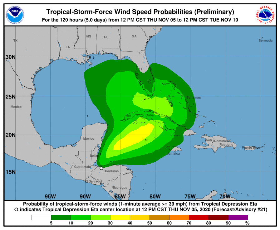
Even if Eta weakens with time, it is likely to bring copious amounts of moisture to southern Florida this weekend into early next week. Whether Eta is a strong or weak tropical cyclone, soaking rains could impact Florida south of I-4 starting later Saturday into Sunday even though the center of the storm is well south of there. Rain and wind could become more severe if Eta gains strength and/or structure after it passes through Cuba.
With much uncertainty, residents in Florida and elsewhere along the U.S. Gulf Coast should closely monitor the future progress of this storm. Advisories
