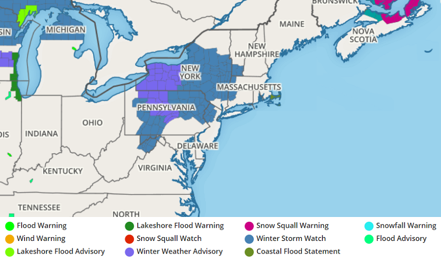
More than a foot of snow appears to be likely for portions of the northeast as a significant, early-season winter storm takes shape. With the odds of a significant snowstorm arriving, the National Weather Service has started to issue Winter Storm Watches for the threat of heavy snow across portions of Pennsylvania, New York, New Jersey, Connecticut, Massachusetts and Vermont for now. More advisories, watches, and warnings will likely be needed as the late Sunday/early Monday winter storm unfolds.
The storm is taking shape over the midwest today. An upper level ridge in the East will flatten out as a low pressure system starts to form on the lee side of the Rockies. This will increase cloud cover into the northeast on Saturday afternoon heading into the evening hours.
On Sunday, a surface low will move into the northeast, bringing precipitation with it. As an upper level low heads east behind it, cyclogenesis will occur off the coast. Through the process of cyclogenesis, a coastal storm will from at the expense of the earlier surface low, wrapping cold air around itself while generating moderate to heavy precipitation. Because the thermal profile with this storm, especially on the southern side of the system, will be iffy since it is so early in the season, a mixed bag of precipitation will be likely there.
For now, it appears plain rain will build into the Mid Atlantic early Sunday morning. From central Pennsylvania and New Jersey northward, precipitation should start out as freezing rain, sleet, snow, or a mix of any. On Sunday afternoon, this mixed bag should turn to plain rain south of I-80. North of there, though, the mixed bag will continue with plain snow likely falling from around I-84 north. Rain could become heavy at times from I-78 south, including the New York City metro area later on Sunday. As that happens, cold air will wrap on the back side of the system for Monday, changing rain to snow as far south as central Pennsylvania and New Jersey.
While measurable snow is possible from Philadelphia to New York, it is still too early to say with certainty how much, if any could fall. However, just north of there, from the Poconos into far northern New Jersey into southern and central Upstate New York, northern Connecticut and Rhode Island, western Massachusetts, and southern New Hampshire and Vermont, heavy snow is likely to fall with some areas seeing well over a foot of snow before the system wraps up Monday evening. Given the uncertainties with where the cyclogenesis will occur on Sunday, it is still too early to say how far south this heavier snow will develop. For now, it appears unlikely heavy snow would fall south of I-195 in central New Jersey; it is also unlikely heavier snow will fall south of a line from Tinicum to Kennett Square in Pennsylvania.
This will likely be a long duration storm with two main periods of winter weather. Conditions on Sunday are expected to consist of a mix of snow, sleet, and ice, with snow accumulations under 2 inches where wintry precipitation is forecast to occur. Everywhere, a lull in precipitation is possible Sunday evening, with most of the snow falling between later Sunday night and Monday morning.
