Forecast models used by meteorologists to aid with their weather forecasting are suggesting the possibility that December may kick off on a snowy note across portions of the Mid Atlantic and Northeast; while lake effect snow is likely throughout the rest of this month, there could be a more substantial winter weather event away from the Great Lakes in December’s first days.
The GFS and ECMWF are among many computer models meteorologists use to assist in weather forecasting. While meteorologists have many tools at their disposal to create weather forecasts, two primary global forecast models they do use are the ECMWF from Europe and the GFS from the United States. While the models share a lot of the same initial data, they differ with how they digest that data and compute possible outcomes. One is better than the other in some scenarios, while the opposite is true in others. No model is “right” all the time. Beyond the ECMWF and GFS models, there are numerous other models from other countries, other academic institutions, and private industry that are also considered when making a forecast.
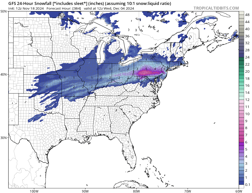
While the ECMWF and GFS both bring precipitation to the parched Northeast and Mid Atlantic later this month and early December, the American GFS forecast model is showing colder storm systems and a storm track that would support more snow than simply rain, especially in portions of the Mid Atlantic.
It is too soon to say with any certainty whether these forecast models are right or wrong, or which one is likely to be more accurate than the other for now, but its clear weather patterns are evolving which will set the stage for different conditions in the weeks ahead.
In places like Pennsylvania, New Jersey, Delaware, New York and Connecticut, a significant drought has unfolded with a prolonged period of time passing without any precipitation. With the pattern evolving, much needed rain will fall in areas that desperately need it over the next few weeks. In another 7-10 days, meteorologists should know better if the returning precipitation will also be aligned with colder temperatures which could produce a snowy start to the new meteorological season which begins December 1.
