Computer forecast models are suggesting that very warm temperatures will be heading to the Eastern U.S. soon, just days after the Blizzard of 2026 buried many under feet of snow.
The GFS and ECMWF are among many computer models meteorologists use to assist in weather forecasting. While meteorologists have many tools at their disposal to create weather forecasts, two primary global forecast models they do use are the ECMWF from Europe and the GFS from the United States. While the models share a lot of the same initial data, they differ with how they digest that data and compute possible outcomes. One is better than the other in some scenarios, while the opposite is true in others. No model is “right” all the time. Beyond the ECMWF and GFS models, there are numerous other models from other countries, other academic institutions, and private industry that are also considered when making a forecast.
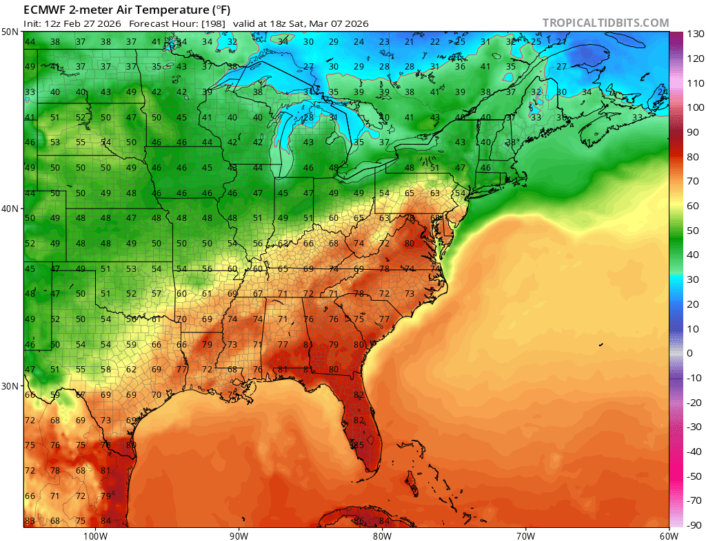
For now, both the ECMWF and GFS are calling for a dramatic warm-up in the coming days across the eastern United States. While temperatures will be in the low to mdi 90’s in portions of Texas, warm air will stretch across the Gulf of America coast with 80’s likely in Louisiana, Alabama, Mississippi, and Florida as soon as Tuesday. More mild air is expected to build north and east, bringing readings into the high 70’s for places like Kentucky, West Virginia, and Virginia. By next Saturday, readings in the low 80’s are modeled for places as far north as central Virginia, with 70’s extending into much of central and eastern Pennsylvania and the southern half of New Jersey.
As with winter storms modeled by these computer simulations, there could be significant differences in the coming days and how the mild air spreads may be different than it is currently modeled.
Nevertheless, the National Weather Service believes a post-Blizzard warm-up is in the clouds. “In wake of wintry systems earlier in the week, a significant warm-up is expected starting late next week into next weekend,” says the National Weather Service office in Mount Holly, New Jersey. They add, “GEFS and ECENS guidance are in pretty good agreement that positive height anomalies are forecast over the eastern CONUS with troughing over the western CONUS. CPC probabilities suggest that there is a 60-70% chance that temperatures will be above normal.”
