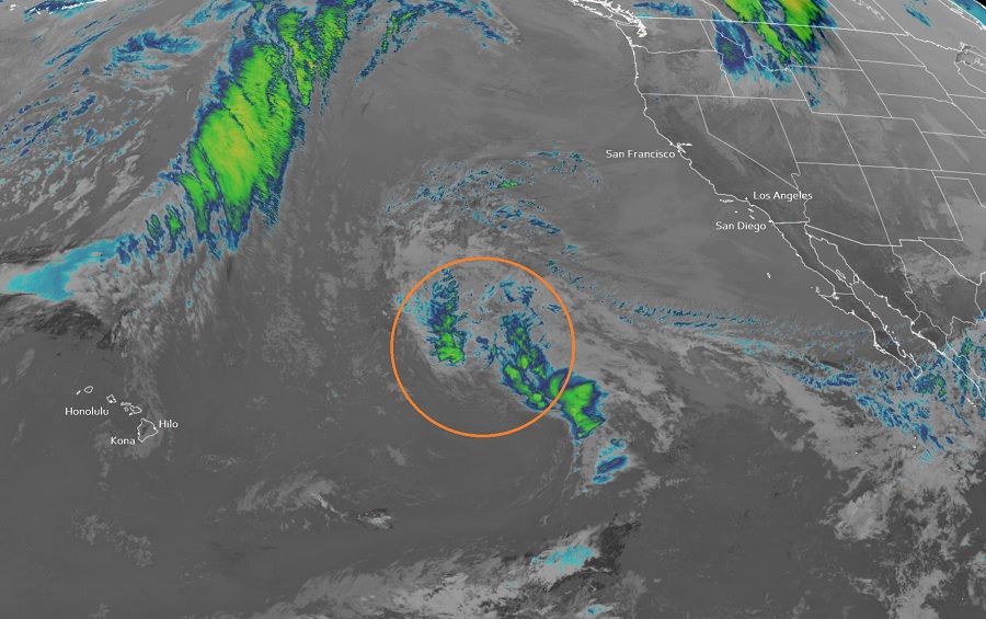
While the calendar says we’re in the middle of winter, Mother Nature may have other plans in store: a freak storm in the Pacific Ocean between Hawaii and California is being monitored for signs of possible tropical cyclone development.
The National Hurricane Center (NHC) in Miami, Florida is monitoring the disturbance in the Pacific. A well-defined area of low pressure producing gale-force winds is located just over 1,000 miles east-northeast of Hilo on the Big Island of Hawaii. According to the NHC, shower and thunderstorm activity has recently increased in coverage and organization near the center. While environmental conditions appear only marginally favorable for additional development, the NHC says that if this activity persists, it could result in the formation of a short-lived subtropical or tropical cyclone over the next day or so. By Friday, environmental conditions are expected to become unfavorable for additional development.
Computer forecast guidance is mixed with regards to the future potential of this storm. The GFS and ECMWF are among many computer models meteorologists use to assist in weather forecasting. While meteorologists have many tools at their disposal to create weather forecasts, two primary global forecast models they do use are the ECMWF from Europe and the GFS from the United States. While the models share a lot of the same initial data, they differ with how they digest that data and compute possible outcomes. One is better than the other in some scenarios, while the opposite is true in others. No model is “right” all the time. Beyond the ECMWF and GFS models, there are numerous other models from other countries, other academic institutions, and private industry that are also considered when making a forecast.
Currently, the GFS has this disturbance dissipating with time as its remnants slide south of Hawaii’s Big Island. Some remnant moisture could reach Hawaii in time, but the GFS suggests it would be more an open wave than any cyclonic threat.
However, the ECMWF is a bit more robust with its solution, suggesting a more developed area of low pressure that slides into Hawaii over time from the north. While it doesn’t suggest a hurricane, it could be a more potent system with more rain and wind if this model’s track actually materialized.
For now, the National Hurricane center will continue to monitor this unusual disturbance. While the Eastern Pacific Hurricane Season doesn’t start until May 15, and the Central Pacific Hurricane Season doesn’t start until June 1, tropical or subtropical cyclones do form from time to time in the “off season.” While having one form in the Pacific between Hawaii and California now would be very rare, it wouldn’t be impossible: the NHC says there’s a 40% chance that something will take shape here over the next 48 hours.