• Skip to primary navigation
  • Skip to main content
  • Skip to primary sidebar

Weatherboy

Weatherboy Weather News, Maps, RADAR, Satellite, and Forecasts.

  • Local
  • Earth Science News
  • RADAR
  • Current Warnings
  • Satellite
  • Current Maps
  • Forecast Maps
  • Video

Freezing Temperatures To Be Replaced By Much Warmer Readings

by Weatherboy Team Meteorologist - May 10, 2020

Warmer temperatures will surge north throughout the week, with temperatures near 80 reaching as far north as Philadelphia by Friday. Image: tropicaltidbits.com


Very cold temperatures on Mother’s Day morning will soon to be replaced with more summer-like temperatures as a late-winter weather pattern is quickly replaced by a late-spring one.

The National Weather Service is warning about frost and freeze threats across a large portion of the eastern United States. Image: weatherboy.com
The National Weather Service warned about frost and freeze threats across a large portion of the eastern United States early today. Image: weatherboy.com

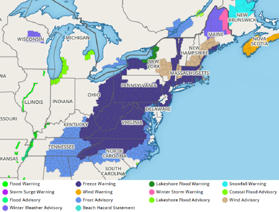
Literally freezing cold temperatures were measured throughout a large part of the eastern United States early today. The arrival of these very cold morning temperatures prompted the National Weather Service to issue Freeze Warnings and Frost Advisories from New York south to Georgia and Alabama.

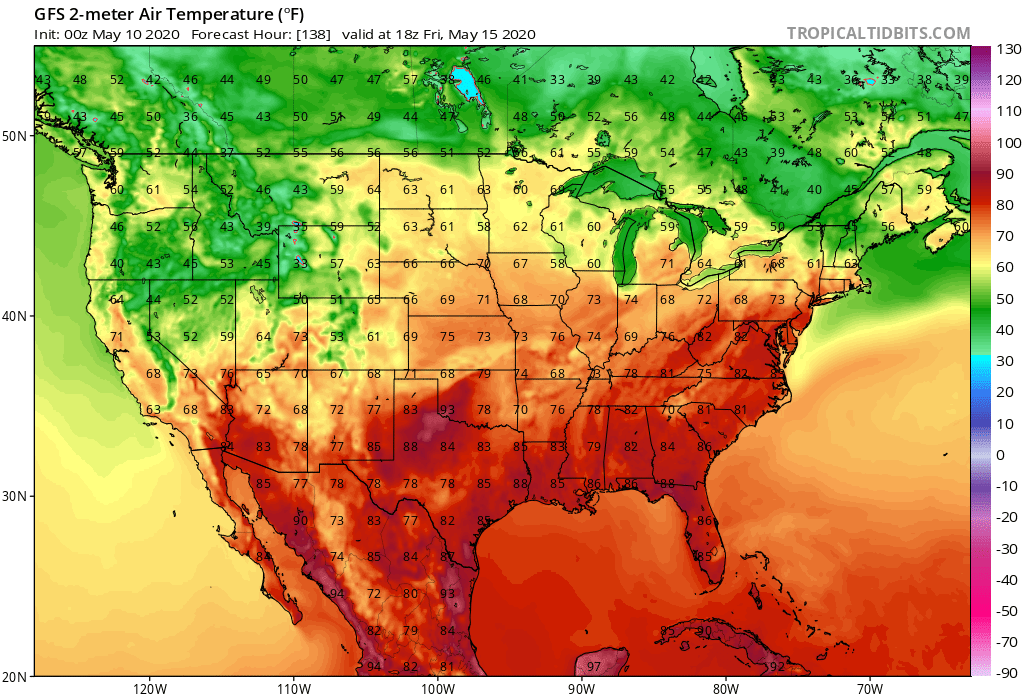
However, a changing weather pattern will make those frost and freeze issues a concern of the past rather quickly.  High pressure will build just off the U.S. East coast, allowing warm readings in the southern states to start moving north into the Ohio Valley and the Mid Atlantic. By Friday, towns in West Virginia, Virginia, Maryland, Delaware, southern Pennsylvania, an southern New Jersey will approach or even exceed the 80 degree mark. Conditions will remain very warm around the Gulf Coast with highs in the mid to upper 80’s expected there.


The latest American GFS computer forecast model suggests temperatures as warm as the low 90's may slide as far north as New Jersey in the next 2 weeks. Image: tropicaltidbits.com
The latest American GFS computer forecast model suggests temperatures as warm as the low 90’s may slide as far north as New Jersey in the next 2 weeks. Image: tropicaltidbits.com

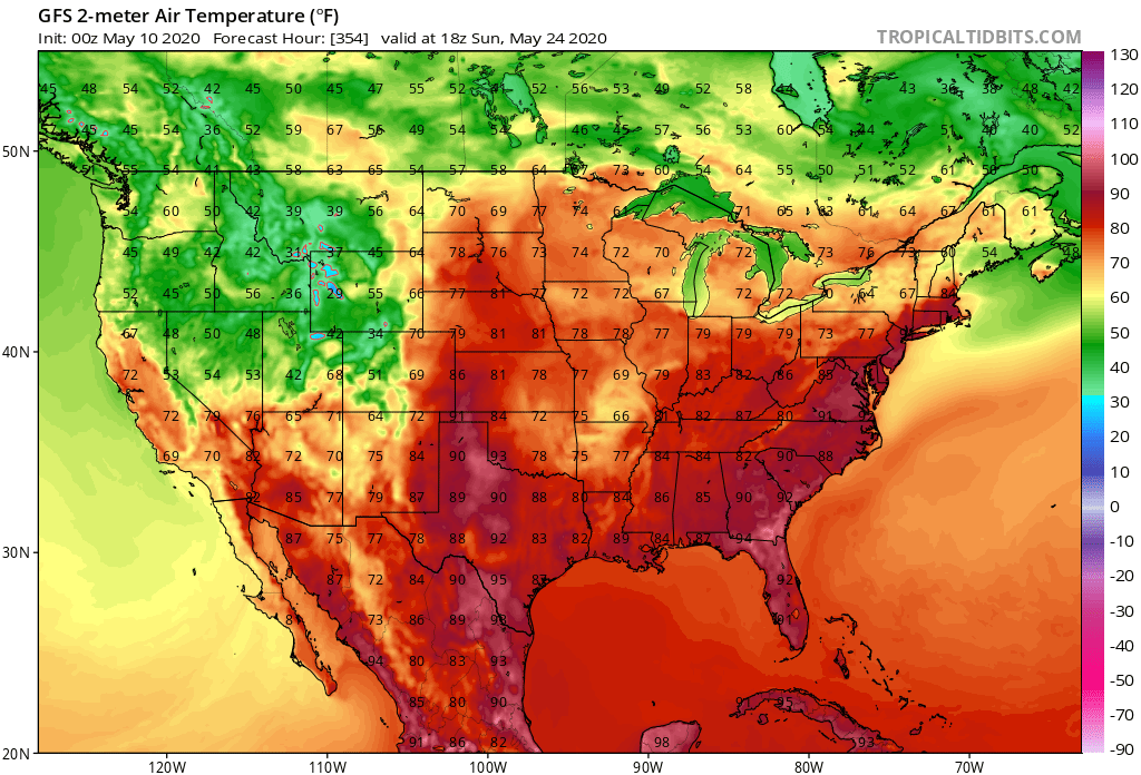
While the mild air mass will moderate over time, it looks like another surge of warmer temperatures is possible in about a week and a half too. By then, areas flirting with the 80 degree mark in the Mid Atlantic could see temperatures near 90.

Primary Sidebar

Sponsored Ad

Search

Latest News

  • Chief of Weather Agency Fired in Wake of Spy Balloon Drama; Second Balloon Reported Near Hawaii
  • U.S. East Coast Airspace Reopens after Military Strike Against Chinese Spy Balloon
  • Global Computer Forecast Models Keep Snow Out of I-95 Corridor through At Least Mid-February
  • Giant Spy Balloon from China Floating over Northern U.S., Forcing Airport & Airspace Closures
  • 2023 Groundhog Day Forecast In: 6 More Weeks of Winter
  • Green Comet to be Visible Tonight; It’ll Visit Earth Again in 45,000 Years
  • Today is the 20th Anniversary of Space Shuttle Columbia Disaster
  • Loud Explosions over Portions of New Jersey Likely on Saturday; Won’t be Thunder
About | Careers | Contact | Contests
Terms | Privacy | Ad Choices
Weatherboy is a (R) Registered Trademark of isarithm LLC, All Rights Reserved.
All content herein is Copyright by Isarithm LLC 1997-2022