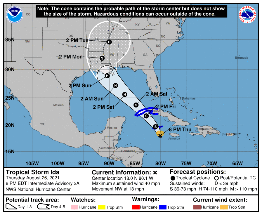
The central Gulf Coast of the United States is on alert tonight with the expected arrival of Ida in the coming days, which forecast guidance suggests will be a major hurricane when it impacts the U.S. at the end of the weekend. Right now, tropical storm conditions are impacting the Caribbean from Ida, which became a tropical storm this afternoon.
As of the latest advisory from the National Hurricane Center, Tropical Storm Ida is about 115 miles southeast of Grand Cayman and about 120 miles west of Negril, Jamaica. Maximum sustained winds are 40 mph, with higher gusts, with a minimum central pressure of 1006 mb or 29.71″. For now, the storm is moving off to the northwest at 13 mph.
In expectation of storm conditions, local governments have issued Tropical Storm Warnings for the Cayman Islands and the Cuban provinces of Matanzas, Mayabeque, Havana, Artemisa, Pinar del Rio, and the Isle of Youth. A Tropical Storm Warning means that tropical storm conditions are expected somewhere within the warning area within 36 hours. While no watches or warnings are up for the U.S. coastline now, the National Hurricane Center (NHC) in Miami, Florida says that is likely to change by late tonight or early tomorrow when new watches are posted for portions of the U.S. Gulf Coast.
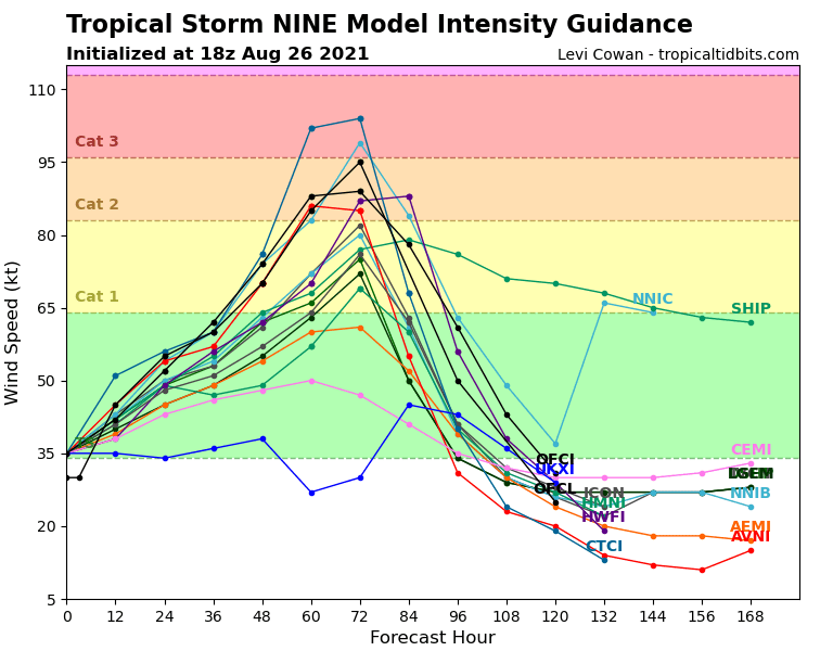
On the official forecast track from the NHC, the center of Ida will pass near or over the Cayman Islands tonight, the Isle of Youth and western Cuba Friday, and over the southeastern and central Gulf of Mexico Friday night and Saturday. The system is forecast to approach the U.S. northern Gulf coast on Sunday. The NHC says steady strengthening is forecast during the next few days. Ida is forecast to become a hurricane when it is near western Cuba with additional strengthening expected while it moves over the Gulf of Mexico. The NHC warns that Ida could be near major hurricane strength when it approaches the northern Gulf coast, with maximum sustained winds of around 125 mph.
