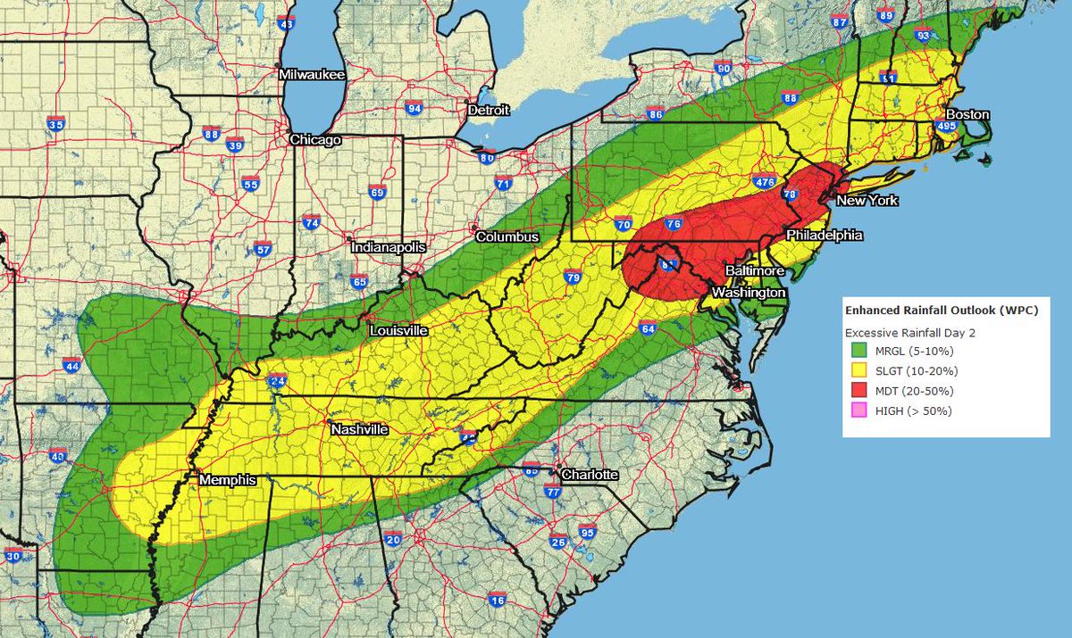
Very heavy, flooding rains are expected to fall in a region that doesn’t need more rain: the Mid Atlantic. However, while flooding rains will arrive, the extreme heat that impacted the region over the last few days will exit. The threat of excessive rain is high enough that the National Weather Service’s Weather Prediction Center has highlighted an area stretching across the Mid Atlantic, including the highly-trafficked Washington, DC to New York City, NY corridor, as a moderate risk zone for flooding rains.
Showers and thunderstorms will develop along and ahead of an approaching front today. The heaviest rain is expected from this afternoon through the overnight hours. According to the National Weather Service, this region has observed well above normal precipitation over the past two weeks making the soil extremely sensitive to additional rainfall. With watersheds full and soil saturated, potentially numerous flash flooding events are possible. The National Weather Service is advising people that localized flooding from the Tennessee Valley into portions of the Northeast is likely.
Some severe thunderstorms could also develop here. Damaging wind gusts, large hail, and the risk of isolated tornadoes can’t be ruled out in this same area. People should stay weather aware and be ready to take immediate action should a Severe Thunderstorm Warning or Tornado Warning be issued for their county.
The frontal system responsible for very heavy rain will also bring relief from the recent extreme heat blast that brought heat indexes over 115 to this same region over the weekend. As the front eventually pushes through the region on Tuesday, the rain will end from northwest to southeast. By Wednesday, fair high pressure will return to the area with dry conditions, warm temperatures, and low humidity levels.
