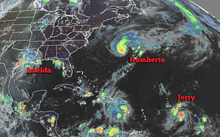
While Texas continues to deal with flooding rains associated with what’s left of yesterday’s landfalling Tropical Storm Imelda, Bermuda is dealing with hurricane conditions this evening as Hurricane Humberto passes by just to the north and west of the island. While hurricane conditions will gradually taper away on Bermuda, the possibility of storm conditions in the caribbean ahead of Jerry is triggering the issuance of watches there.
As of the latest advisory from the National Hurricane Center (NHC), the center of the large eye of Hurricane Humberto was located by satellite and Bermuda weather radar data near latitude 33.4 North, longitude 65.0 West. Humberto is moving toward the east-northeast near 20 mph. This general motion with an additional increase in forward speed is expected through early Thursday, followed by a northeastward to north-northeastward motion through Friday. On the forecast track, the core of Humberto will continue to pass north of Bermuda this evening. Maximum sustained winds are near 120 mph with higher gusts, making Humberto a major category 3 hurricane on the Saffir-Simpson Hurricane Wind Scale. Some fluctuations in intensity are likely during the next day or so, but Humberto should remain a powerful hurricane through early Thursday while it passes close to Bermuda. A steady weakening trend should begin later on Thursday.
While the eye won’t cross Bermuda, because it is a large hurricane, Bermuda will still feel severe impacts from this storm. Hurricane-force winds extend outward
up to 80 miles from the center and tropical-storm-force winds extend outward up to 195 miles. An automated station at Pearl Island recently reported sustained winds of 100 mph and a wind gust of 123 mph while Wade International Airport recently reported a wind gust of 115 mph. 2-4″ with isolated 6″ rainfall amounts are expected on Bermuda, creating flooding issues. Dangerous breaking waves, especially along south-facing beaches, will be possible Wednesday night into Thursday, and could cause coastal flooding. Wave heights exceeding 30 feet have already been reported by an offshore NOAA buoy. Swells will continue to affect the northwestern Bahamas and the southeastern coast of the United States from east-central Florida to North Carolina during the next couple of days. These swells could cause life-threatening surf and rip current conditions.

While Bermuda deals with Humberto, the Caribbean is preparing for Jerry which is forecast to become a hurricane in the coming days. The government of Antigua and Barbuda has issued a Tropical Storm Watch for Barbuda and Anguilla; it joins St. Maarten, St. Martin, St. Barthelemy, Saba, and St. Eustatius already under a watch. A Tropical Storm Watch means that tropical storm conditions are possible within the watch area, generally within 48 hours.
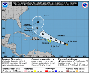
As of the latest advisory from the NHC, the center of Tropical Storm Jerry was located near latitude 15.2 North, longitude 51.2 West. Jerry is moving toward the west-northwest near 15 mph. A west-northwest motion at a slightly faster forward speed is expected by the NHC over the next few days. On the forecast track, the center of Jerry will be near or north of the northern Leeward Islands Friday and pass north of Puerto Rico on Saturday. Maximum sustained winds are near 60 mph with higher gusts. For now, the NHC expects Jerry to become a hurricane on Thursday, with little change in strength anticipated on Friday or Saturday. Tropical-storm-force winds extend outward up to 45 miles from the center, where the estimated minimum central pressure is 1000 mb or 29.53 inches.