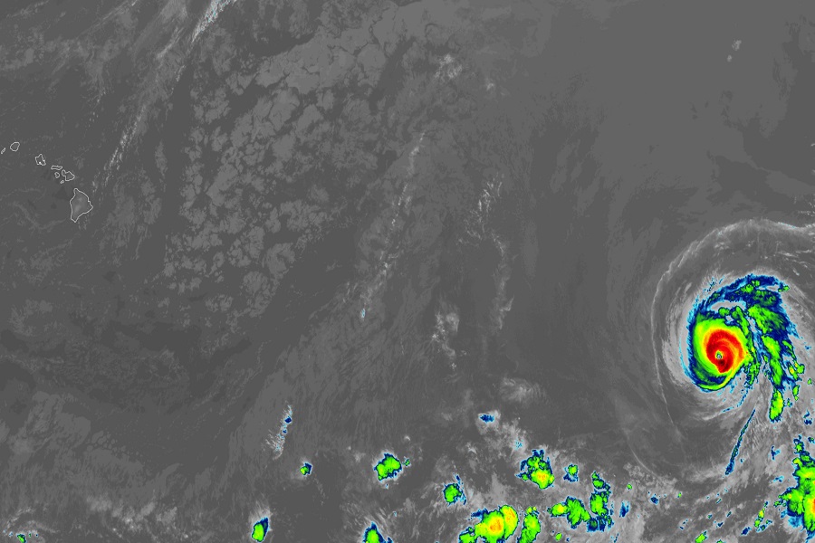
Hurricane Calvin continues to gain strength, becoming the first Major Hurricane of the 2023 Eastern Pacific Hurricane Season with maximum sustained winds of 120 mph, making it a Category 3 hurricane on the Saffir-Simpson Hurricane Wind Scale. The National Hurricane Center now believes impacts to Hawaii from this storm are likely next week, with a landfall expected as soon as late Tuesday night or early Wednesday morning on the east coast of the Big Island of Hawaii.
According to the latest update from the National Hurricane Center in Miami, Florida, Major Hurricane Calvin was located roughly 2,140 miles east-southeast of Hilo and 2,210 miles east-southeast of Kona on the Big Island of Hawaii. The storm is moving west at 16 mph while the storm’s minimum central pressure is down to 960 mb or 28.35″. This weekend Calvin is expected to cross over from the Eastern Pacific hurricane basin to the Central Pacific hurricane basin; when that happens, the National Hurricane Center in Miami will transition the forecasting and advisory issuance of this storm to the Central Pacific Hurricane Center located in Honolulu on the Hawaiian island of Oahu.
Calvin may not be done gaining strength. The National Hurricane Center says a west to west-northwest motion at a similar forward speed is expected during the next several days. Meanwhile, they also say that some additional strengthening is possible today.
While the National Hurricane Center’s current forecast track brings Calvin to Hawaii, it does so as a much weaker storm. As Calvin moves over colder water that is between where it is at now and the Hawaiian Islands, weakening is forecast to commence tomorrow and continue through early next week. The official forecast brings Calvin to Hawaii as a tropical or post-tropical cyclone with only tropical storm force winds. Nevertheless, there could be significant issues with some wind damage, flooding rains, rough surf, and the hazards that come with it such as beach erosion, coastal flooding, and rock slides.
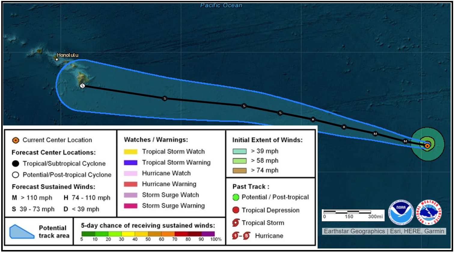
National Weather Service’s Jeff Powell, who serves as a Lead Meteorologist / Hurricane Specialist at the Honolulu, Hawaii office said they continue to closely monitor the evolving situation. In today’s latest Forecast Discussion, Powell writes, “We continue to monitor Hurricane Calvin in the East Pacific, which is expected to cross 140W into the Central Pacific Basin late Sunday as a weakening tropical storm. It is too early to specify details regarding impacts to the main Hawaiian Islands from Calvin or its remnants. However, impacts could begin as early as Tuesday into Wednesday of next week. Impacts to the state could include high surf, heavy rain, strong winds, or all of the above.”
As part of annual hurricane season preparation activities, people are being encouraged by county and state emergency management and civil defense agencies throughout Hawaii to make a Hurricane Action Plan. As confidence grows in the forecast track and the forecast intensity of the storm, people in the path of Calvin will be asked to active their plan.
