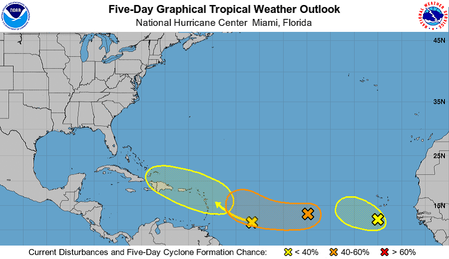
With the peak of the Atlantic Hurricane Season a month away, the tropical Atlantic is beginning to perk up with tropical cyclone formation possible in the coming days. The National Hurricane Center in Miami, Florida is currently monitoring three systems that could develop over the next five days. For now, none have an immediate shot of becoming a tropical cyclone, but that could change beyond 48 hours.
The first system of concern is located a little more than 100 miles south of the southwesternmost Cabo Verde Islands, where shower and storm activity have increased today. According to the National Hurricane Center, some gradual additional development is possible during the next day or so but strong upper-level winds and cooler waters are likely to prevent significant development after that time. The system is expected to move generally west-northwestward to northwestward across the eastern tropical Atlantic at 10 to 15 mph. Regardless of development, locally heavy rainfall and gusty winds are possible over portions of the southernmost Cabo Verde Islands tonight and Sunday. For now, the National Hurricane Center believes there’s only a 30% chance of tropical cyclone formation either over the next 48 hours or five days.
The next area of concern is a small but well-defined area of low pressure located over the tropical Atlantic about 1,000 miles west of the Cabo Verde Islands which continues to produce limited shower activity. The National Hurricane Center says environmental conditions are expected to become a little more favorable for gradual development over the next several days, and this system could become a tropical depression by the middle of next week. The system is forecast to drift toward the west-southwest or west during the next couple of days, and then move a little faster toward the west-northwest early next week. Of the three systems being tracked today, this shows the greatest odds of becoming a tropical cyclone. While formation chances are a low 20% over the next 48 hours, they grow to a medium 40% over the next five days.
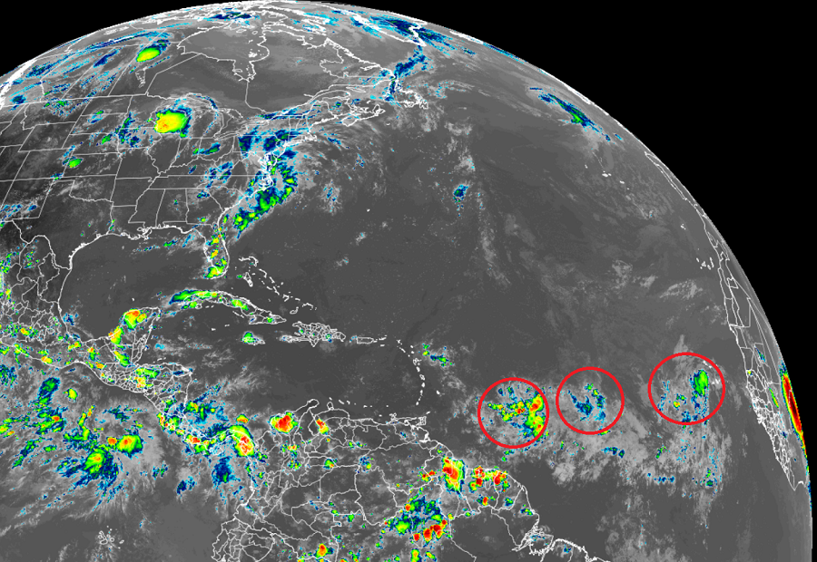
The last system of concern is a tropical wave located over the west-central tropical Atlantic. Right now, it is producing limited shower and thunderstorm activity. The National Hurricane Center says that significant development of this system is not anticipated as it moves west-northwestward across the Lesser Antilles and eastern Caribbean Sea during the early to middle part of next week. They peg odds of tropical cyclone formation at 0% over the next 48 hours and only 10% over the next 10 days.
Elsewhere, tropical cyclone formation isn’t expected anywhere in the Atlantic Hurricane Basin for the next 5 days.
The 2021 Atlantic Hurricane Season runs through to the end of November.
