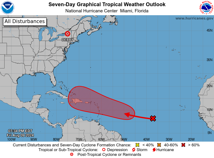
The National Hurricane Center now says it is likely a disturbance in the central Atlantic Ocean will develop into a tropical cyclone in the coming days; while they monitor that threat, long range computer forecast guidance suggests the system may develop into Hurricane Ernesto and become a U.S. East Coast threat.
Shower activity associated with a tropical wave located about 900 miles west-southwest of the Cabo Verde Islands has become a little better organized since yesterday. According to the National Hurricane Center, slow development of this system is possible during the next couple of days while it moves westward to west-northwestward across the central tropical Atlantic. Conditions are then expected to become more conducive for development thereafter, and a tropical depression is likely to form by early next week while the system approaches and then moves near or over the Lesser Antilles. The system is forecast to continue moving generally west-northwestward and could approach portions of the Greater Antilles by the middle part of next week.
Right now, in their latest Tropical Outlook, the National Hurricane Center says there is a 70% chance that this disturbance will become a tropical cyclone within the next 7 days.
Both the American GFS and European ECMWF forecast models suggest the storm could become a hurricane over time. When and if the system strengthens from a tropical depression into a tropical storm, it would be named Tropical Storm Ernesto. If it does grow more into a hurricane, it would be upgraded to Hurricane Ernesto.