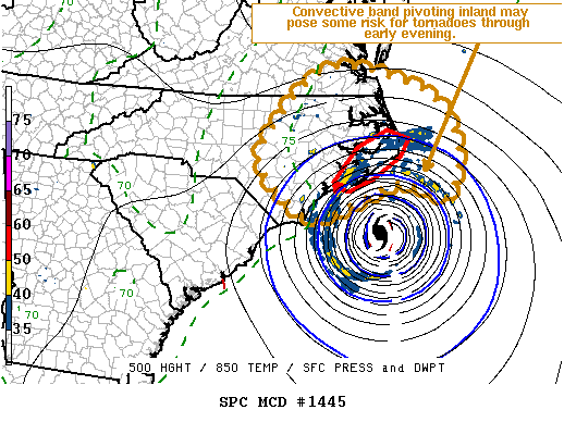
As bands from massive Hurricane Florence spiral to land, tornadoes may form. According to the National Weather Service’s Storm Prediction Center, there may be at least some increasing risk for a couple of tornadoes this evening, mainly across the Outer Banks and immediate coastal areas. Showers have increased in coverage, with perhaps a few weak thunderstorms, across coastal southeast Virginia into the portions of the Piedmont of North Carolina. This is generally northwest through north of Hurricane Florence, but in the presence of sizable and gradually enlarging low-level hodographs associated with its approach.
In a mesoscale discussion, the Storm Prediction Center said, “Although low-level shear may already be potentially supportive of some risk tornadoes, evaporative cooling and downward mixing of relatively warm and dry air above the boundary layer appears to be contributing to the maintenance of an unfavorable low-level thermodynamic stratification.”
The threats of tornadic activity will pick up as the convective bands pivoting from Florence circle into the Carolinas. The greatest threat will remain over eastern North Carolina on the northern side of the hurricane’s impacts.
