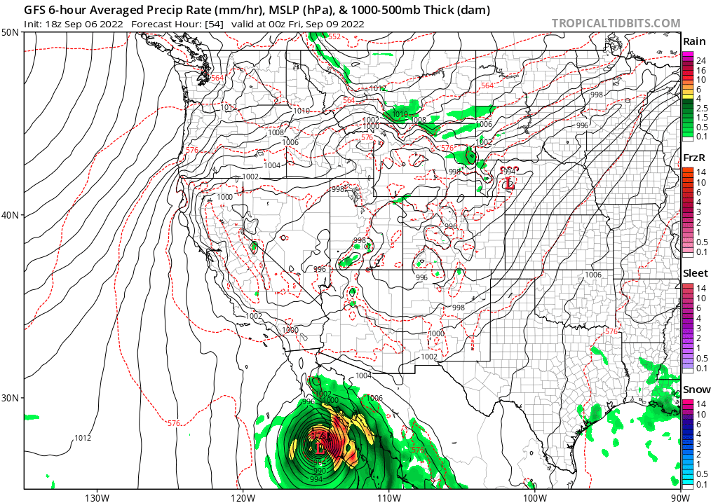
While Hurricanes Danielle and Earl spin about in the Atlantic, the National Hurricane Center is also tracking Hurricane Kay in the Pacific; moisture from this storm could soak portions of California this weekend as the system moves up the coast of Baja California.
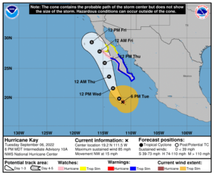
For now, the 85 mph hurricane is swirling about 275 miles south-southwest of the southern tip of Baja California. The hurricane has a minimum central pressure of 976 mb or 28.82″. The storm is currently moving northwest at 15 mph, triggering many watches and warnings to be issued.

Right now, a Hurricane Watch is in effect for Puerto Cortes to Punta Eugenia. A Tropical Storm Warning is in effect from Punta Abreojos south to Cabo San Lucas and from Cabo San Lucas north to Santa Rosalia. A Tropical Storm Watch is in effect north of Santa Rosalia to Bahia de Los Angeles and for the area north of Punta Eugenia to San Jose De Las Palomas.
Each watch and warning carries a different meaning. A Hurricane Watch means that hurricane conditions are possible within the watch area. A watch is typically issued 48 hours before the anticipated first occurrence of tropical-storm-force winds, conditions that make outside preparations difficult or dangerous. A Tropical Storm Warning means that tropical storm conditions are expected somewhere within the warning area within 36 hours. A Tropical Storm Watch means that tropical storm conditions are possible within the watch area, generally within 48 hours.
According to the National Hurricane Center (NHC), interests north of the watch area on the Baja California peninsula should closely monitor the progress of Kay as additional tropical storm watches could be required tonight.
While the storm is moving north-west now, the NHC expects a turn toward the north-northwest on Wednesday; this motion should continue into Friday. On the forecast track, the center of Kay is expected to pass to the west of the southern Baja California peninsula on Wednesday, and be near the west-central coast of the Baja California peninsula Thursday and Friday.
According to the NHC, strengthening is forecast during the next 36 hours, and Kay could become a major hurricane during that time. Weakening is forecast to begin by Thursday, but Kay is forecast to remain a strong hurricane when it passes near the Baja California peninsula.
Hazards from wind, storm surge, and rain are expected through Friday. Hurricane conditions are possible in the Hurricane Watch area beginning Thursday. Tropical storm conditions are expected in the Tropical Storm Warning area beginning Wednesday morning and are forecast to spread northward Wednesday night and Thursday. Tropical storm conditions are possible in the Tropical Storm Watch area on Thursday. A storm surge could produce coastal flooding near where the center passes the coast in areas of onshore winds, or east of the center if Kay makes landfall. The surge will be accompanied by large and destructive waves. Kay is expected to produce rainfall totals of 6-10″ with isolated maximum rain amounts of up to 15″ across the central portions of the Baja California peninsula through Friday. These rainfall amounts could lead to flash flooding, including landslides. Swells generated by Kay will continue to affect portions of the coast of southwestern Mexico during the next couple of days. Large swells are expected to spread northward along the Baja California coast and into the Gulf of California during the next few days. According to the NHC, these swells will likely cause life-threatening surf and rip current conditions.

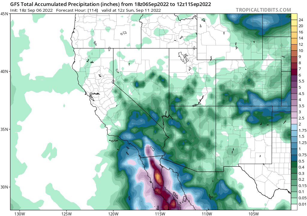
Later Friday, Kay should rapidly weaken as it moves north into much colder Pacific waters. While the center of the storm won’t impact the state of California directly as a tropical cyclone, moisture from the storm should make its way into southern portions of the state. While 1-2″ of rain could fall on Saturday in portions of the Los Angeles metro area, 1.5-2.5″ could fall around the San Diego metro area. Mountains away from the coast could see over 5″ of rain. Western Arizona and southern Nevada could also see a few inches of rain which could lead to flash flood issues on Saturday.