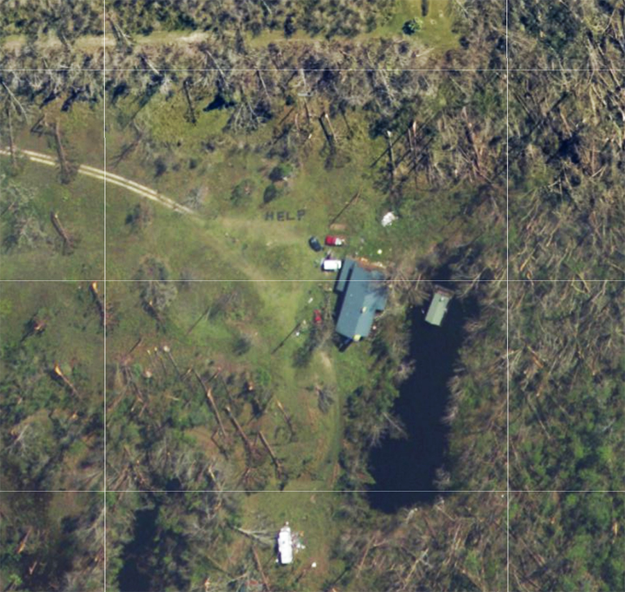
Some clever Hurricane Michael survivors got the help they needed after a curious relative checked out post-storm footage made available online. After the near-Category 5 strength hurricane smashed through the Florida Panhandle, Amber Gee was curious what kind of damage was inflicted on her grandmother’s property in Youngstown, Florida. Amber used a link online to explore post-storm photography made available by NOAA and she was shocked by what she saw: her family asking for help.
With power out and communication links severed, Gee’s aunt, uncle, and family friend were trapped at their damaged property. Knowing that aerial reconnaissance would be done after the storm left, they took tree branches and storm debris and spelled out the words “help” on the ground.
When Gee spotted the words “help” in the NOAA photographs, she immediately reached out to local authorities last Sunday. Those authorities then went in and rescued the three storm survivors.
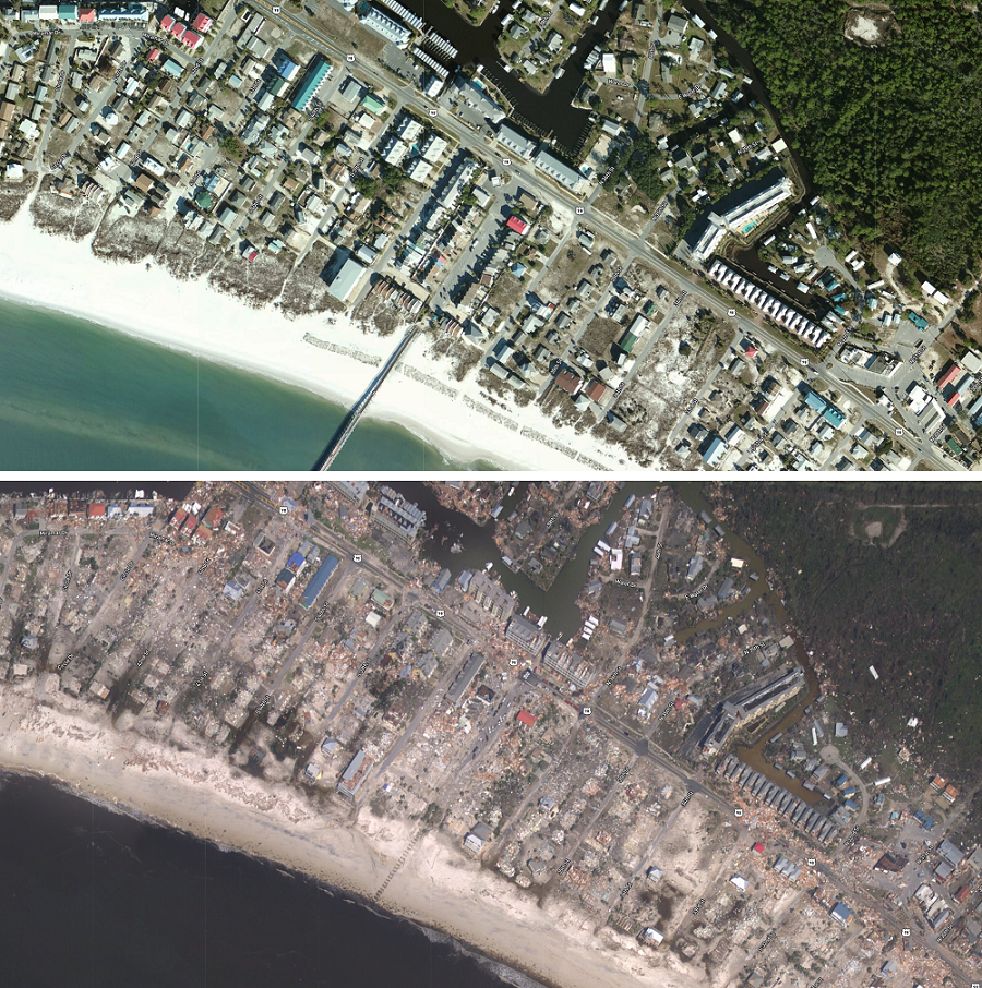
This imagery was acquired by the NOAA Remote Sensing Division to support NOAA homeland security and emergency response requirements. In addition, it will be used for ongoing research efforts for testing and developing standards for airborne digital imagery. Individual images have been combined into a larger mosaic and tiled for distribution. The approximate ground sample distance (GSD) for each pixel is ~25 cm / zoom level 19.
Images from the coast from Fort Morgan at the Florida/Alabama border east to Marsh Island south and west of Tallahassee are available for viewing. The entire city of Panama City is also available for viewing.
The stunning images can be viewed and downloaded for free at this link: https://storms.ngs.noaa.gov/storms/michael/index.html#9/30.0085/-85.6549
A link to the image with the word “HELP” in it can he seen at this link: https://storms.ngs.noaa.gov/storms/michael/index.html#19/30.33128/-85.41867
