As the 2018 Hurricane Season continues, activity in the Eastern Pacific continues to perk up while the Atlantic is quiet for now. However, some computer forecast models are suggesting that the activity in the Atlantic basin could pick up in about a week, with possible threats to the US Gulf Coast.
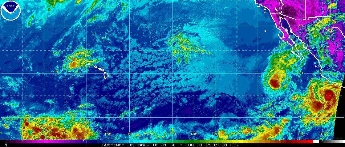
Tropical Storm Aletta, which was once a Category 4 hurricane, was centered near 16.5N 115.1W or 480 nautical miles southwest of the southern tip of Baja California in the last Tropical Weather Discussion issued by the National Hurricane Center. Aletta was moving west at 5kt and had an estimated minimum central pressure is 1002 mb. Maximum sustained winds are near 45mph with gusts to 55mph. Aletta continues to weaken rapidly with the combination of strong vertical shear, cooler sea surface temperatures, and dry air entrainment. The latest National Hurricane Center forecast has Aletta weakening to a tropical depression late tonight.
While Aletta is losing steam, Tropical Storm Bud is gaining strength. Centered near 14.7N 103.5W 360 nautical miles south-south-east of Cabo Corrientes, Mexico, Bug is moving northwest at 8 kt. Bud’s estimated minimum central pressure is 994 mb while maximum sustained wind speed is around 60mph with gusts to 70mph. The National Hurricane Center says Bud will continue to intensify as it moves on a northwestward track; they expect the system to reach hurricane intensity tonight.
Over time, Bud could impact the Baja Penninsula; residents there should closely monitor the future progress of this storm. Eventually, moisture from this system could also enter the southwestern United States, creating potential flood problems there.
Neither system will impact Hawaii which is dealing with the ongoing Kilauea eruption event there.
While the Pacific is active, the Atlantic hurricane basin is quiet. The National Hurricane Center expects no tropical development there for at least the next five days. However, beyond five days, conditions could be conducive for a tropical system to form in the Gulf of Mexico by next weekend. While there is no hurricane or tropical storm threat on the US coast in the short term, residents located near coastal communities, especially those on the Gulf Coast, should make sure they are properly prepared for this hurricane season.
