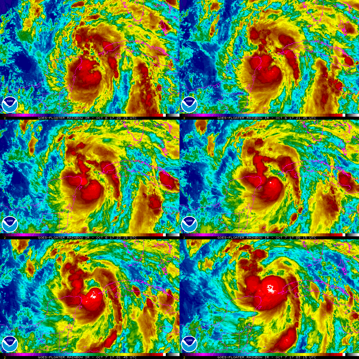
The National Hurricane Center has upgraded Tropical Storm Nate to Hurricane Nate. An Air Force Reserve Hurricane Hunter aircraft just penetrated the center of Nate and reported hurricane-force winds. The maximum
winds are estimated to be 75 mph with higher gusts. With maximum sustained winds of 75mph, Nate is a Category 1 hurricane; it is forecast to gain additional strength on Saturday before making landfall on the US Gulf Coast.
As of 11:30pm ET, Hurricane Nate was centered near 22.4N 86.3W, which is 95 miles west north west of the western tip of Cuba and roughly 495 miles south south east of the mouth of the Mississippi River. Nate is moving north north west at 22mph. Minimum central pressure is 988mb or 29.18″.
Latest summary of watches and warnings issued for Nate:
Hurricane Warning
* Grand Isle Louisiana to the Alabama/Florida border
* Metropolitan New Orleans and Lake Pontchartrain
Storm Surge Warning
* Morgan City Louisiana to the Okaloosa/Walton County Line Florida
* Northern and western shores of Lake Pontchartrain
Tropical Storm Warning
* Punta Herrero to Rio Lagartos Mexico
* Pinar del Rio Cuba
* Lake Maurepas
* West of Grand Isle to Morgan City Louisiana
* East of the Alabama/Florida border to the Okaloosa/Walton County Line
Hurricane Watch
* Lake Maurepas
* East of the Alabama/Florida border to the Okaloosa/Walton County Line
* West of Grand Isle to Morgan City Louisiana
Storm Surge Watch
* East of the the Okaloosa/Walton County Line to Indian Pass Florida
Tropical Storm Watch
* East of the Okaloosa/Walton County Line to Indian Pass Florida
* West of Morgan City to Intracoastal City Louisiana
* Isle of Youth Cuba
Efforts to protect life and property in the United States from the arrival of Hurricane Nate should be completed as quickly and as calmly as possible.