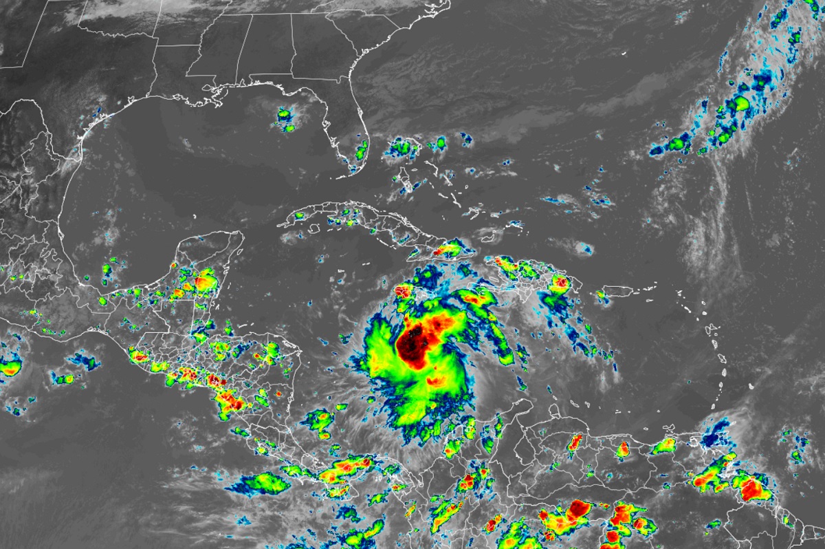
Tropical Storm Ian continues to become a bit better organized, gaining strength as it does so. With Ian expected to become a major hurricane before a potential Florida landfall, Florida Governor Ron DeSantis has declared a State of Emergency there.
“Today, I extended the State of Emergency for Tropical Storm Ian to all 67 counties in Florida. I encourage all Floridians to continue to monitor the storm and listen to local officials,” said Governor DeSantis in remarks about the storm.
Ian is expected to produce heavy rainfall, flash flooding, and possible mudslides in areas of higher terrain, particularly over Jamaica and Cuba. Limited flash and urban flooding is possible with rainfall across the Florida Keys and Florida peninsula through mid next week.

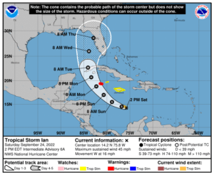
Hurricane conditions are possible in the Cayman Islands by early Monday, with tropical storm conditions possible by late Sunday. Tropical storm conditions are possible in Jamaica on Sunday.
Ian is forecast to move near or over western Cuba and approach the west coast of the Florida peninsula at or near major hurricane strength early next week, where there is increasing confidence in multiple life-threatening hazards: storm surge, hurricane-force winds and rainfall flooding. While it is too soon to determine the exact magnitude and location of these hazards, residents in Cuba, the Florida Keys, and the Florida peninsula should ensure they have their hurricane plan in place, follow any advice given by local officials, and closely monitor updates to the forecast.
Right now, Tropical Storm Ian is located about 270 miles south-southeast of Kingston, Jamaica and about 505 miles southeast of Grand Cayman. Maximum sustained winds have increased to 45 mph while minimum central pressure has dropped to 1003 mb or 29.62″.
The government of the Cayman Islands has upgraded the Hurricane Watch to a Hurricane Warning for Grand Cayman, and has changed the Hurricane Watch to a Tropical Storm Watch for Little Cayman and Cayman Brac.
A Tropical Storm Watch remains in effect for Jamaica.
Warnings and watches have different meanings. A Hurricane Warning means that hurricane conditions are expected somewhere within the warning area. A warning is typically issued 36 hours before the anticipated first occurrence of tropical-storm-force winds, conditions that make outside
preparations difficult or dangerous. Preparations to protect life and property should be rushed to completion. A Tropical Storm Watch means that tropical storm conditions are possible within the watch area, generally within 48 hours. Interests in western and central Cuba, the Florida Keys, and the Florida peninsula should monitor the progress of Ian.
The latest track from the National Hurricane Center brings Ian, as a major hurricane, to the Florida Gulf coast by the middle part of the week. It is still too early to say exactly where landfall will occur and how strong it’ll be when it gets there. It is also too early to tell how much of the eastern United States will be impacted by this storm or its remnants. It is within the realm of possibilities that every eastern state from Maine to Florida could be impacted eventually by this storm …or what’s left of it.