Tropical Storm Jerry formed this morning, the latest named tropical cyclone of an active Atlantic hurricane season. But while the National Hurricane Center in Miami, Florida expects the storm to become a hurricane over time, they don’t believe it will impact the U.S. East Coast, avoiding it like the recent previous hurricanes have too.
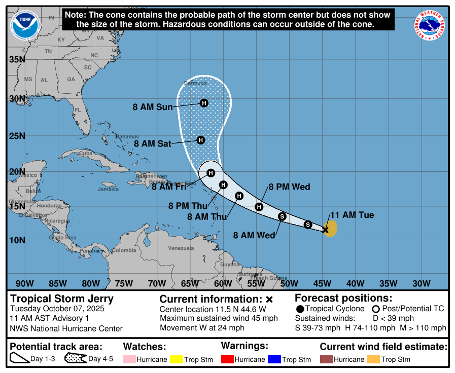
Jerry, the 10th named storm of the 2025 Atlantic Hurricane Season, is currently about 1,315 miles east-southeast of the Northern Leeward Islands in the central Tropical Atlantic. With maximum sustained winds up to 45 mph and minimum central pressure down to 1006 mb or 29.71″, the storm is far enough from land to not warrant any coastal watches or warnings at this time.
Jerry is moving toward the west near 24 mph. According to the National Hurricane Center, a decrease in forward speed and a turn to the west-northwest is expected during the next couple of days. On the forecast track, the core of the system is expected to be near or to the north of the northern Leeward Islands late Thursday and Friday. While it tracks closer to the Leeward Islands, steady strengthening is forecast, and Jerry is expected to become a hurricane in a day or two.
But like other recent storms, the weather pattern in the western Atlantic is likely to curve the storm out to sea, missing the U.S. East Coast and Bermuda. However, both of these places will still see indirect impacts in the coming days. Swells generated by Jerry are expected to reach the Leeward Islands on Thursday. Swells are likely on portions of the U.S. East Coast this weekend. These swells are likely to cause life-threatening surf and rip current conditions.
