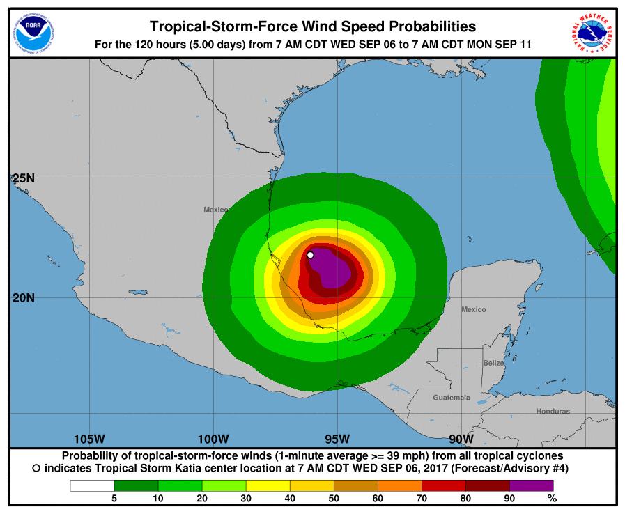
With the peak of the 2017 Atlantic Hurricane Season quickly approaching, it is no surprise there are many tropical threats in the basin: the latest is Katia, which is becoming a hurricane now. Data shows the storm is at hurricane strength now; the National Hurricane Center (NHC) needs to confirm that data and make the official upgrade.
While that data is showing Katia has maximum sustained winds of about 80mph, the last official advisory from the NHC showed it had top winds of only 45mph. It’s moving, or drifting, east south east at about 5 mph. There’s no watches up yet, but the NHC says Hurricane Watches may be needed soon for parts of the Mexican state of Veracruz later today.
Tropical-storm-force winds extend outward up to 45 miles from the center but that could expand as the storm takes on more hurricane characteristics.
The greatest threat from this storm will be from flooding rains. Katia is expected to produce total rain accumulations of 5 to 10 inches over northern Veracruz, and 2 to 5 inches over far southern Tamaulipas, northeast Puebla, and southern Veracruz through Saturday morning. Isolated maximum amounts of 15 inches are possible in northern Veracruz. This rainfall may cause life-threatening flash floods and mudslides, especially in areas of mountainous terrain.