After a relatively long slumber of quiet since the end of the 2018 eruption of Kilauea’s Lower East Rift Zone, lava has returned to the volcano’s caldera with a fresh eruption to end 2020 with a literal bang.
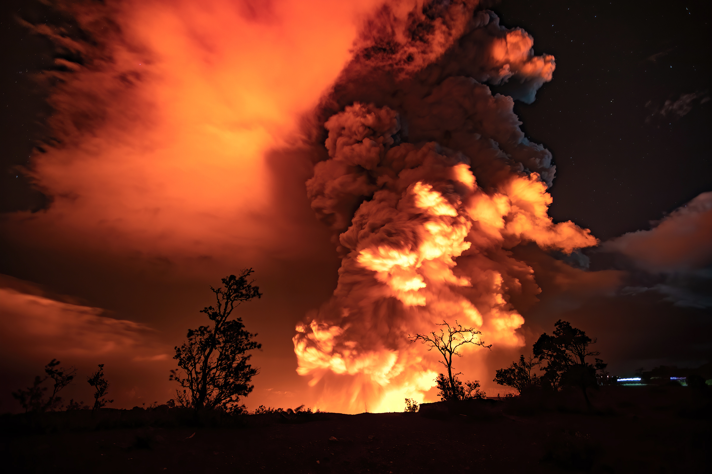
Shortly after approximately 9:30 pm local time, the USGS Hawaiian Volcano Observatory (HVO) detected glow within Halemaʻumaʻu crater at the summit of Kīlauea Volcano declaring that an eruption commenced within Kīlauea’s summit caldera. As a result, HVO elevated Kīlauea’s volcano alert level to “WARNING” and its aviation color code to “RED”.
And then roughly an hour later, at 10:36pm, HVO recorded a magnitude-4.4 earthquake located beneath Kīlauea Volcano’s south flank. The earthquake was centered about 8.7 miles south of Fern Forest, near the Hōlei Pali area of Hawai‘i Volcanoes National Park at a depth of 4 miles.
According to HVO acting Scientist-in-Charge David Phillips, “HVO continues to monitor Kīlauea as the situation is rapidly evolving with this evening’s eruption at the summit of Kīlauea. We will send out further notifications on Kīlauea and other Hawaiian volcanoes as we observe changes.”
Kīlauea’s south flank has been the site of over 30 earthquakes of magnitude-4.0 or greater during the past 20 years. Most are caused by abrupt motion of the volcano’s south flank, which moves to the southeast over the oceanic crust. The location, depth, and waveforms recorded as part of this earthquake are consistent with motion along the south flank detachment fault.
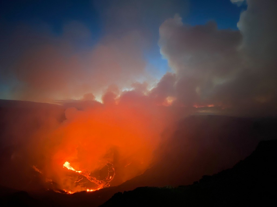
With daylight back and scientists exploring both the volcanic site and the data captured there, a more comprehensive understanding of the ongoing eruption is becoming known. Right now, there are 3 fissure vents on the wall of Halemaʻumaʻu crater inside Kilauea’s caldera which are feeding lava into a growing lava lake there. A plume is rising from the eruption site; according to USGS, this plume consists mainly of water vapor, CO2, SO2, with trace amounts of other gases. Those gasses are drifting with the wind; for now, those winds are steering it to the south and west over unpopulated areas of the park.
The National Weather Service office in Honolulu, responsible for issuing weather advisories for all of Hawaii, issued a special weather statement at the time of the initial eruption. “Low level trade winds will push any embedded ash towards the southwest, and any ash fallout will likely occur over the Kau Disttrict and Highway 11 southwest of the town of Volcano. This includes the communities of Pahala, Wood Valley, Naalehu, and Ocean View. Avoid excessive exposure to ash which is an eye and respiratory irritant. Those with respiratory sensitives should take extra precaution to minimize exposure.” Shortly after midnight, the National Weather Service said the threat and volume of material had diminished, with no additional advisories issued. During the 2018 eruption, the National Weather Service created new ash advisories as part of their product offering.
