A Kona Low is set to pounce the islands of Hawaii, bringing heavy rain, thunderstorms, and even snow to portions of the state over the next several days. With severe weather arriving, the National Weather Service in Honolulu, Hawaii has already issued Flash Flood Watches for western islands in the state and more advisories could be issued elsewhere in the Aloha State.
The Kona Low gets its name from the change in wind direction that occurs when such a storm moves over the Hawaii Islands. Hawaii is dominated by the trade winds that typically blow in from the northeast. However, the counter-clockwise flow around a Kona low located west of Hawaii results in southwesterly winds over the islands, which is typically the leeward or “Kona” side. Kona Lows are most common between October and April. These type of storms draw abundant moisture up from the warm tropical waters that surround Hawaii; when this moist flow interacts with the steep topography of the island which helps to wring-out moisture, extremely heavy precipitation can fall. Because the wind flow around a Kona Low is atypical, flooding rains occur in places that may not ordinarily flood in tropical downpours that impact the islands from time to time.
Winds will gradually transition to southerlies as a more unsettled weather pattern develops Tuesday through Friday. The developing Kona Low will increase the potential for heavy rain and thunderstorms across Kauai and Oahu as early as Tuesday morning before spreading this potential to the remaining islands over the following days. Shower coverage will gradually diminish Friday through the weekend, though the potential for locally heavy showers may continue as the low aloft lingers.

With an area of high pressure positioned well north-northeast of the state of Hawaii, a surface trough will continue to develop west of Kauai. The resulting pressure gradient between the high and the low is driving moderate to locally breezy east-southeast winds across the island chain now. Computer forecast models show a low will close off from the surface trough west of Kauai on Tuesday. On Wednesday, once associated upper troughing closes off and aligns with the surface low, the system will officially become a Kona Low a few hundred miles west of Kauai. Moderate southerly winds will develop across the islands by late Tuesday and hold in place through Wednesday. A deep southerly flow will take shape over the western islands Tuesday and Tuesday night as the storm system develops. As the storm evolves, shower coverage and intensity will increase across Kauai and Oahu, along with the potential for heavy rainfall and a few thunderstorms. More limited shower activity across Maui County and the Big Island is expected through Tuesday night, although deeper moisture moving in from the south may reach the Big Island toward daybreak Wednesday.
A Flood watch remains in effect for the islands of Niihau, Kauai and Oahu from Tuesday morning through Thursday afternoon. According to the National Weather Service, heavy rainfall and thunderstorms will gradually encompass the entire state, most likely Wednesday through Thursday. In the latest Forecast Discussion, meteorologists with the National Weather Service caution, “The Flood Watch may be expanded to the rest of the state at some point later tonight or tomorrow morning.”

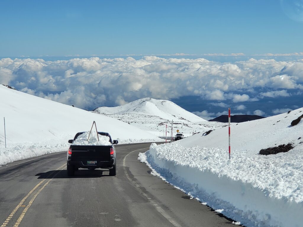
In addition to heavy rain, significant snow may fall too. While most people don’t associate the tropical paradise Hawaii is known for with snow, they’re surprised to learn that it does snow in the winter due to the elevation of its volcanic peaks. Mauna Kea is the highest of the bunch at 13,803 feet. Maui’s Haleakala is much lower at 10,023 feet. Because of that difference, Hawaii Island will see snow more frequently than the lower Maui Island. Just one storm in January 2020 dropped 2-3 feet of snow on Hawaii Island and created snow drifts that were far deeper. Another storm in 2021 brought snowboarders and skiers out to the mountain by the dozens. Winter Weather Advisories were even issued last May when a late-season system brought wintry weather to Hawaii Island.
There are no winter weather related advisories, watches, or warnings in effect for Hawaii at this time, but that could change as the storm approaches. Most snow would fall on the higher peaks of Hawaii Island late Wednesday or Thursday.
As the Kona Low begins to break down, winds will shift more southeasterly for the second half of the week. The pressure gradient will also relax significantly over the weekend with light and variable winds expected due to broad surface troughing in place over the islands. Because of the changing wind direction and speeds, shower coverage should gradually decrease Friday through the weekend. However, brief heavy precipitation and scattered thunderstorms can’t be completely ruled out due to the presence of the nearby upper low.