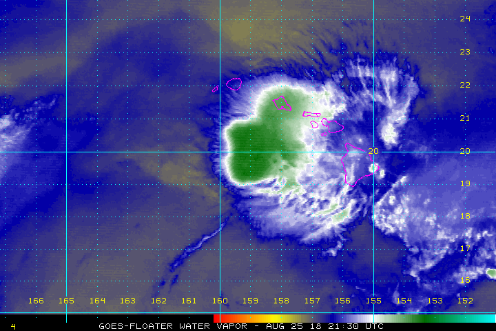
While Lane weakens and moves away from Hawaii, epic rainfall and historic flood threats will persist on Hawaii’s Big Island. While Lane remains a tropical storm for now, maximum sustained winds are only at 50mph. In the latest advisory from the Central Pacific Hurricane Center (CPHC), the center of Tropical Storm Lane was located about 145 miles southwest of Honolulu and about 160 miles south of Lihue. Lane is moving to the west at 7 mph, slowly beginning to creep away from the Aloha State.
According to the CPHC, Lane is expected to continue moving to the west and increase in forward speed through tomorrow. This track will keep Lane south of Kauai and Niihau tonight. Because there’s no longer a threat of tropical storm force winds in Hawaii, all Tropical Storm Watches and Warnings have been discontinued for land areas.
While Lane moves away, flash flooding will continue to be a concern through the weekend and into the first part of the week. Slow moving rain bands continue to impact the islands primarily from Oahu through the Big Island. Lane is expected to produce additional rain of 5-10 inches over windward Big Island and Maui and 3-5 inches elsewhere through the weekend. More than 20″ of rain has already fallen over some portions of Hawaii, with a few reports over 40″ already. As of 9pm last night, Waikakea Uka reported 42.81″ while Piihonua has 42.69″. Saddle Quarry received 38.77″ while Waiakea got 37.91″. More rain fell since those amounts were recorded and more is on the way.
The National Weather Service office in Honolulu is compiling storm totals and plans to send rainfall amounts through noon today around 2pm HT.
As Lane heads west away from Hawaii, a trailing deep tropical moisture axis is forecast to hold over the western end of the state through the first half of the new week as Lane turns north well west of Kauai. This will keep the threat for heavy rain and flooding in place for several days, with the primary threat on windward facing slopes.
After a few days of unsettled weather which will likely create more flood and landslide issues, dry weather should return to Hawaii during the midweek while moderate trade winds return from east to west.
