A large, wintry, icy, messy storm system will continue to unfold over the next few days, bringing heavy snow, an accumulation of ice, and much colder temperatures to portions of the United States between now and Friday afternoon.
A strong cold front extending from the Lower Great Lakes to the Southern Plains will move eastward off most of the East Coast by Friday evening. The front is producing a broad prolonged significant winter weather that impacts much of the central U.S. and moves into parts of the Northeast later tonight, bringing a variety of winter weather hazards, including heavy snow, sleet, and freezing rain. The system will be prolonged with several rounds of winter weather lasting through Friday for portions of the central U.S. before shifting to the interior Northeast.
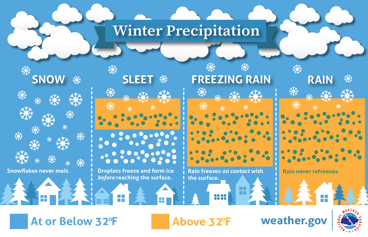
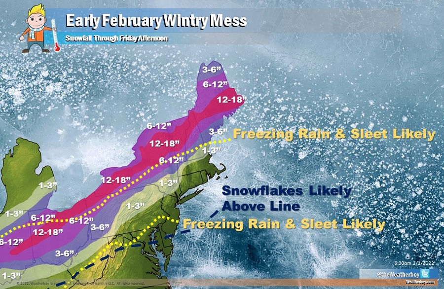
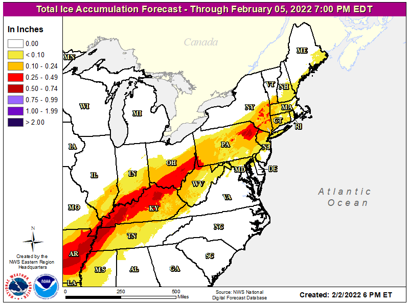
Heavy snow will develop over the Southern Rockies and from the Southern/Central Plains and the Middle Mississippi Valley through the Great Lakes/Ohio Valley and Interior Northeast. In addition, a corridor of heavy ice (rain/freezing rain) accumulation is likely from Texas through the Ohio River Valley, especially from eastern Arkansas northeastward to western Kentucky. The heavy ice (rain/freezing rain) accumulation would likely result in power outages, tree damage, and dangerous travel conditions. Accumulating sleet an freezing rain is also expected across portions of Pennsylvania, New Jersey, Connecticut, New York, Rhode Island, Massachusetts, and southern Vermont and New Hampshire. Traveling on untreated surfaces here, especially Friday morning, could become dangerous.
Cold air will sink south from Canada, changing the icy mix over to snow down into portions of the Mid Atlantic before all precipitation shuts off Friday afternoon. However, accumulating snow is forecast to remain confined well north and west of the I-95 corridor between Washington, DC and Boston, MA –a big flip from where heavy snow fell in last weekend’s Blizzard Bomb.
By the time the storm wraps up Friday afternoon, around or just over a foot of snow is expected to fall over portions of Indiana, Ohio, Pennsylvania, New York, Vermont, New Hampshire, and Maine. Snow will start out wet but become more powdery as more cold air filters into the storm; as such, clearing roads and sidewalks of snow early and often is advised to reduce the accumulation of ice and frozen slush.
Temperatures will fall quickly Friday evening, with any untreated wet surfaces turning to ice across the northeast. People should extreme caution when going out and about Friday evening and Saturday morning.
