Laura could be a major hurricane prior to its landfall on the U.S. Gulf Coast in the coming days. The latest National Hurricane Center forecast update brings Laura to the coast as a Category 2 storm, but meteorologists there caution that may be a conservative forecast. Earlier today, Air Force Hurricane Hunter aircraft found Laura just south of eastern Cuba with slightly stronger winds.
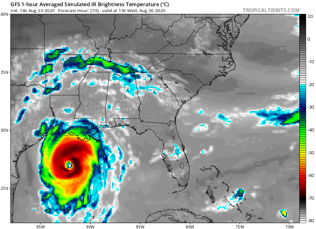
Because Laura is tracking a bit more south than initially forecast, its center of circulation will brush along the south coast or just off-shore Cuba for the next 24-36 hours. Because the center won’t be as disrupted as much by going over the higher terrain of Cuba, it is likely that Laura will emerge into the Gulf of Mexico as a substantial storm with good structure. With low sheer and warm water to work with, a well-structured Laura could take advantage of that environment and intensify, perhaps rapidly so, prior to striking the Gulf Coast. And because Laura is a bit more south than initially expected, the area it could impact along the Gulf Coast could also be a bit further west than initially expected. In the wake of Hurricane Marco, a new round of fresh hurricane and tropical storm watches and warnings could become necessary for portions of Texas, Louisiana, and/or Mississippi.
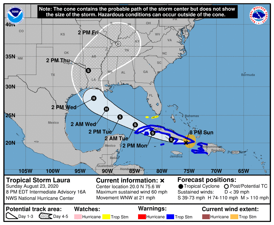
For now, numerous warnings and watches are up ahead of the storm. A Tropical Storm Warning is in effect for the entire coast of Haiti, Little Cayman and Cayman Brac, the Cuban provinces of Camaguey, Las Tunas, Holguin, Guantanamo, Santiago de Cuba, Granma, Ciego De Avila, Sancti Spiritus, Villa Clara, Cienfuegos, Matanzas, Mayabeque, La Habana, Artemisa, Pinar del Rio, and the Isle of Youth. A Tropical Storm Watch is in effect for the Florida Keys from Craig Key to Key West and the Dry Tortugas. The Tropical Storm Warning means that tropical storm conditions are expected somewhere within the warning area, in this case within the next 12 to 24 hours. A Tropical Storm Watch means that tropical storm conditions are possible within the watch area, in this case within the next 24 hours.
As of the 8pm ET advisory, Laura was still a tropical storm with maximum sustained winds of 60 mph. Laura is located about 20 miles west of Guantanamo, Cuba.
