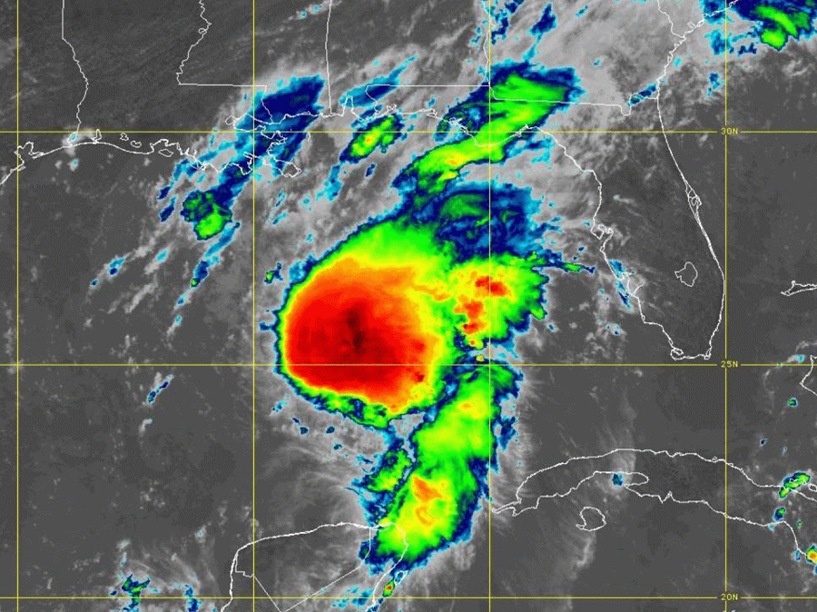
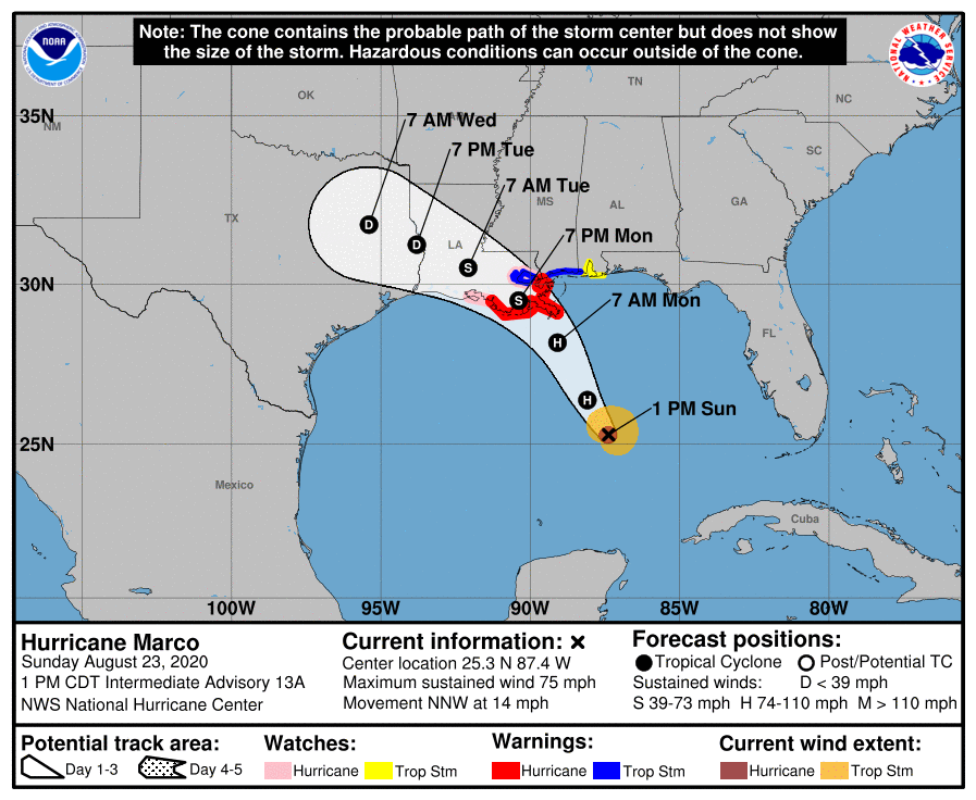
The National Hurricane Center (NHC) in Miami, Florida has issued Hurricane and Storm Surge Warnings ahead of Hurricane Marco’s forecasted arrival on the central Gulf Coast tomorrow. In the latest advisory issued by the NHC, the storm was located about 280 miles south-southeast of the mouth of the Mississippi River and about 440 miles southeast of Lafayette, Louisiana and had maximum sustained winds of 75 mph with a minimum central pressure of 992 mb or 29.29 inches. Residents also need to be aware of the possibility that Laura could also impact this same region just days later as a significant hurricane, bringing even more flooding, storm surge, and wind damage.
Time to protect life and property is running out across portions of Louisiana and Mississippi, including the New Orleans metro area, with storm conditions expected to arrive as soon as late tonight / early tomorrow morning.
For now, a Storm Surge Warning is in effect for Morgan City, Louisiana to Ocean Springs, Mississippi and Lake Borgne. A Storm Surge Warning means there is a danger of life-threatening inundation, from rising water moving inland from the coastline, during the next 36 hours in the indicated locations. “This is a life-threatening situation. Persons located within these areas should take all necessary actions to protect life and property from rising water and the potential for other dangerous conditions. Promptly follow evacuation and other instructions from local officials,” said the National Hurricane Center in a statement.
A Hurricane Warning is also in effect from Morgan City, Louisiana to the Mouth of the Pearl River. A Hurricane Warning means that hurricane conditions are expected somewhere within the warning area; it is typically issued 36 hours before the anticipated first occurrence of tropical-storm-force winds, conditions that make outside preparations difficult or dangerous.
A Storm Surge Watch is also in effect for from Sabine Pass to Morgan City in Louisiana, Ocean Springs, Mississippi to the Mississippi/Alabama border, and for Lake Pontchartrain and Lake Maurepas. A Storm Surge Watch means there is a possibility of life-threatening inundation, from rising water moving inland from the coastline, in the locations under a watch during the next 48 hours.
A Hurricane Watch is in effect for Intracoastal City, Louisiana to west of Morgan City, Lake Pontchartrain, Lake Maurepas, and Metropolitan New Orleans. A Hurricane Watch means that hurricane conditions are possible within the watch area.
A Tropical Storm Warning is also in effect for the area stretching from the mouth of the Pearl River to the Mississippi/Alabama border, Lake Pontchartrain, Lake Maurepas, and Metropolitan New Orleans. A Tropical Storm Warning means that tropical storm conditions are expected somewhere within the warning area within 36 hours.
Lastly, a Tropical Storm Watch is in effect for the area from the Mississippi/Alabama border to the Alabama/Florida border. A Tropical Storm Watch means that tropical storm conditions are possible within the watch area, generally within 48 hours.
There are additional hazards with landfalling tropical cyclones, including inland flash flooding, inland wind damage, and the threat of many tornadoes, especially north and east of the center of the storm. Many watches and warnings could be in effect for specific areas throughout the storm beyond the Storm Surge, Hurricane, and Tropical Storm warnings/watches that are now up.

Right now, Marco is moving toward the north-northwest near 14 mph and this motion is expected to continue through tonight, followed by a turn toward the northwest by Monday. On the forecast track, Marco will cross the central Gulf of Mexico today and will approach southeastern Louisiana on Monday. A gradual turn toward the west-northwest with a decrease in forward speed is expected after Marco moves inland. Marco is expected to be a hurricane when it approaches the northern Gulf Coast on Monday. According to the NHC, rapid weakening is expected after Marco moves inland.
Hurricane-force winds extend outward up to 20 miles from the center and tropical-storm-force winds extend outward up to 100 miles from the center of the storm.
Marco will bring many life-threatening dangers with it: storm surge, damaging winds, and flooding rains.
The combination of a dangerous storm surge and the tide will cause normally dry areas near the coast to be flooded by rising waters moving inland from the shoreline. The water could reach the following heights above ground somewhere in the indicated areas if the peak surge occurs at the time of high tide:
- Morgan City, Louisana to Ocean Springs, Mississippi including Lake Borgne: 4-6′
- Sabine Pass to Morgan City, Louisiana: 2-4′
- Ocean Springs, Mississippi to the Mississippi/Alabama state border: 2-4′
- Lake Pontchartrain and Lake Maurepas: 2-4′
- The Mississippi / Alabama border to the Alabama / Florida border including Mobile Bay: 1-3′
The deepest water will occur along the immediate coast in areas of onshore winds, where the surge will be accompanied by large and dangerous waves. Surge-related flooding depends on the relative timing of the surge and the tidal cycle, and can vary greatly over short distances.
Hurricane-force wind conditions are expected within the hurricane warning area by midday Monday, with tropical storm conditions possible by early Monday. Tropical storm conditions are possible within the tropical storm watch area on Monday, and hurricane conditions are possible within the hurricane watch areas late Monday. Isolated tornadoes are also possible in southeastern Louisiana, including the metropolitan New Orleans area, and southwestern Mississippi.
Marco is expected to produce rainfall accumulations of 2-4″ with isolated maximum amounts of 6″ across the Central U.S. Gulf coast through Tuesday. This rainfall may result in isolated areas of flash and urban flooding along the Central U.S. Gulf Coast.
Rough surf and swells generated by Marco are likely to affect portions of the northern Gulf Coast later today. These swells are likely to cause life-threatening surf and rip current conditions. Even expert swimmers and surfers should remain out of the Gulf of Mexico until both Marco and Laura are long gone.
