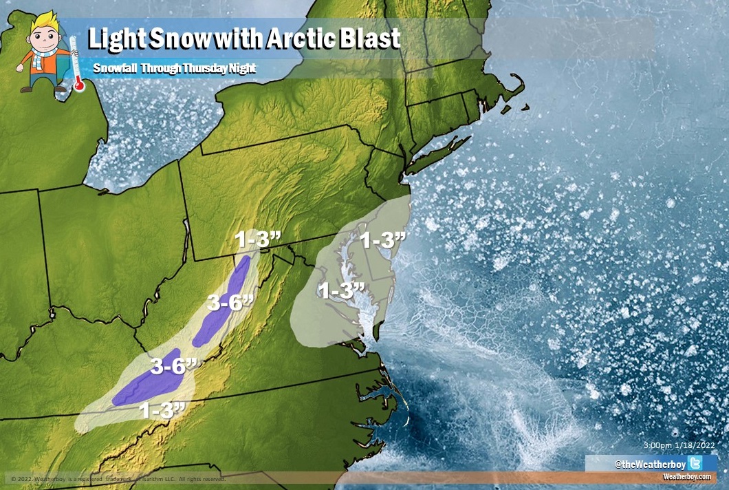
A light snow event is likely to unfold on Thursday as Arctic air moves south and east into the Mid Atlantic and lower Ohio Valley into the Appalachians.
High pressure is forecast to build into the Eastern United States from the west and southwest tonight, quickly heading out to sea on Wednesday. This will allow for an Arctic cold front approaching from the northwest to push through into the Mid Atlantic on Thursday, setting the stage for some light snow. Frigid high pressure is anticipated to follow for Thursday night into the weekend, when an area of low pressure is expected to move off the southeastern U.S. coast.

As the Arctic air arrives, it’ll wring-out moisture out of the atmosphere. While this may start as rain in some places, it will quickly change over to snow and be in the form of light snow across portions of southern New Jersey, southeastern Pennsylvania, Delaware, eastern Maryland and Virginia –including the Washington, DC, Baltimore, and Philadelphia metro areas. Not much snow is expected, but because it’ll fall during a prime commute time, roads could become slick and hazardous and be a high-impact event. Some snow is also likely across eastern West Virginia, western Virginia, eastern Kentucky, and northeastern Tennessee. In this area, 3-4″ of snow is expected in the higher, mountainous terrain there. All in all, the snow will be quick and light and be gone by Thursday evening.
Once that light snow system exits the region, eyes will be on a potentially more impressive weather system. As northern stream energy drops out of the Canadian Prairies late in the week, it could interact with energy and moisture building in the southern stream over the southeastern United States. If all of these ingredients come together, another winter storm could form and impact the U.S. East Coast.

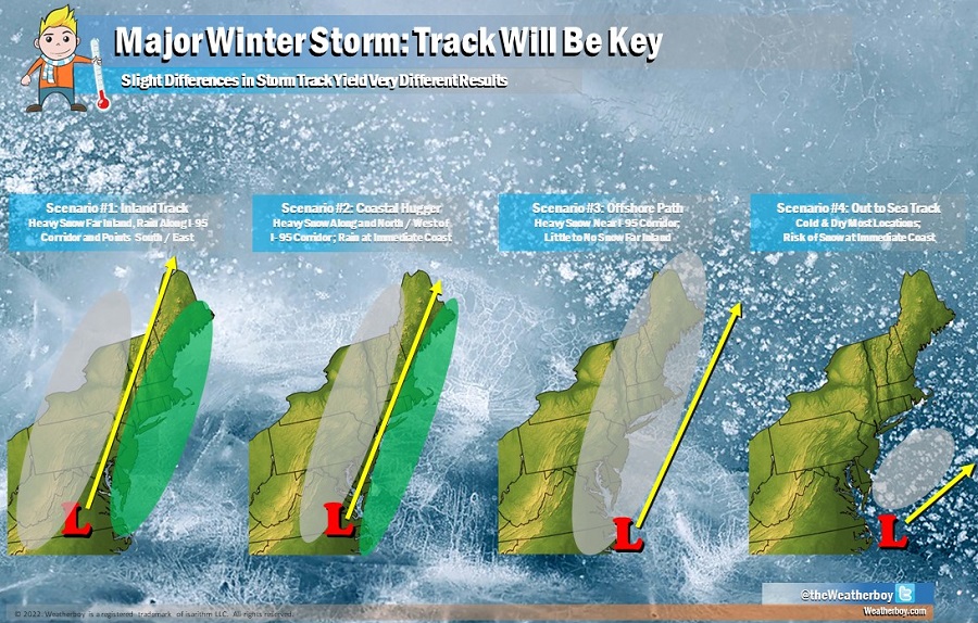
The storm track always helps define who will get precipitation and what kind of precipitation they’ll get. In the first scenario, a storm moves up the northeast well inland; this brings heavy rain well inland and keeps snow even farther inland. The second scenario follows a track similar to what just happened. In this case, the storm traveled up the I-95 corridor, bringing heavy snow far inland, heavy rain at the coast, and an icy mix of snow changing to rain in the middle. But with Arctic air in place and a somewhat different storm track shaping up, it’s possible a third or fourth scenario could occur. In the third scenario, the storm is far enough off-shore to keep precipitation as all snow in the northeast. But because the storm is off shore just far enough, not much in the way of snow falls far inland. In the fourth scenario, the storm moves so far out to sea that little snow is seen anywhere on land, although the immediate coast could see clouds and snowflakes.
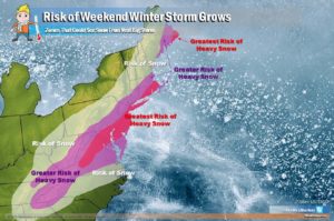
For now, it’s becoming more likely, although not definitive, that this next storm would follow the third or fourth scenario, bringing heavy snow to portions of the Mid Atlantic but not much more inland from there. Precipitation could break out late Thursday over portions of the interior southeast, with ice and snow falling in the southern Mid Atlantic by Friday afternoon. If this scenario continued, snow would break out along the I-95 corridor between Washington, DC and Philadelphia, PA Friday evening and become heavy at times, especially near the I-95 corridor. The snow would continue, heavy at times, early on Saturday before exiting the coast.
The big question remains: will this be more of a scenario #3 or a scenario #4 event? If a #4 event unfolds, snow will struggle to push up the northeast coast. It’s possible places like Virginia could see heavy snow while New York City sees nothing from such a scenario. But if a scenario more like #3 develops, the snow could shift up the coast and impact extreme southeastern New England too.
A lot of what happens in the East on Friday/Saturday is dependent on what happens with a storm impacting the Pacific Northwest and Western Canada on Thursday. The strength and amplification of that system will influence just how amplified the eastern system becomes on Friday/Saturday. As more data is digested by meteorologists and the computer forecast models they use over the next 24 hours, a better, more accurate picture of how things will unfold on Friday will become possible.