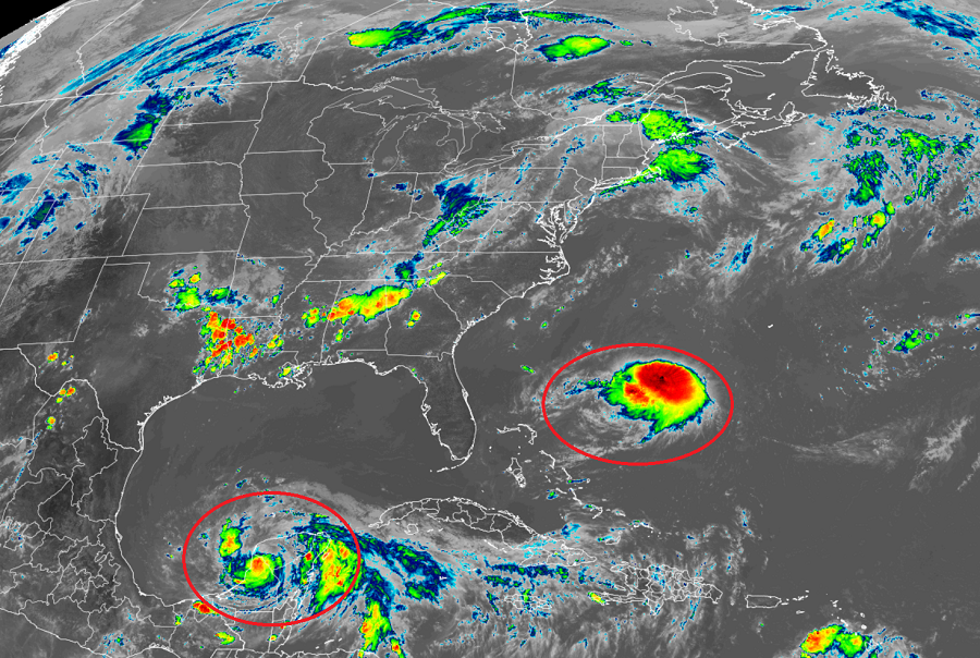
Forecasters at the National Hurricane Center in Miami, Florida are busy tracking three named storms: Tropical Storm Linda approaching Hawaii, Tropical Storm Henri approaching the U.S. East Coast, and Tropical Storm Grace which continues to impact the Yucatan Peninsula in Mexico. While the peak of the Atlantic Hurricane Season is less than a month away, activity is perking up with more systems, some which could also impact the U.S., likely in the weeks ahead.
Tropical Storm Grace, which struck the Yucatan Peninsula as a hurricane, is forecast to re-intensify back to a hurricane as it moves over the open waters of the southern Gulf of Mexico. For now, tropical storm conditions will continue today across the northern Yucatan Peninsula while people prepare on the Mexican mainland for a direct hit from this storm. The National Hurricane Center says hurricane conditions and a dangerous storm surge is likely along portions of eastern mainland Mexico beginning late tomorrow; a Hurricane Warning is in effect from Puerto Veracruz north to Cabo Rojo.
Tropical Storm Henri is just under category 1 hurricane strength as a 70 mph tropical storm. Currently located between the U.S. Southeast coast and Bermuda, the storm is expected to move north in parallel to the east coast. Half of model guidance suggests this storm will strike the northeast coast somewhere between New Jersey and Maine, while the other half suggests a more off-shore route.
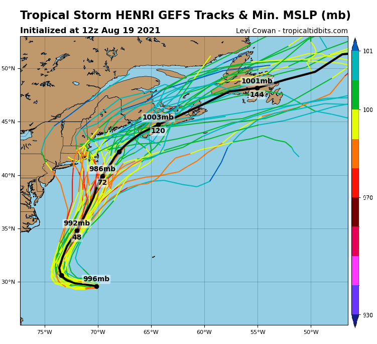
The National Hurricane Center is deploying assets to better understand how strong Henri will get and where it’ll go. The Air Force Reserve Hurricane Hunters will be investigating Henri later today, and the data the aircraft collects will be very helpful in assessing the storm’s structure and strength. In addition to the Air Force aircraft that flies through the storm, the NOAA Gulfstream IV jet will also be flying around Henri later today to help assess the environmental conditions and gather data for the numerical models. The National Hurricane Center say it is hoped that these data collection efforts will help the models more accurately predict the future track of the storm.
Meanwhile, in the Eastern Pacific basin, the National Hurricane Center is getting ready to hand-off Tropical Storm Linda to the meteorologists at the Central Pacific Hurricane Center in Honolulu, Hawaii on the island of Oahu. There, meteorologists will issue any advisories for Hawaii that may become necessary in the coming days from this storm.
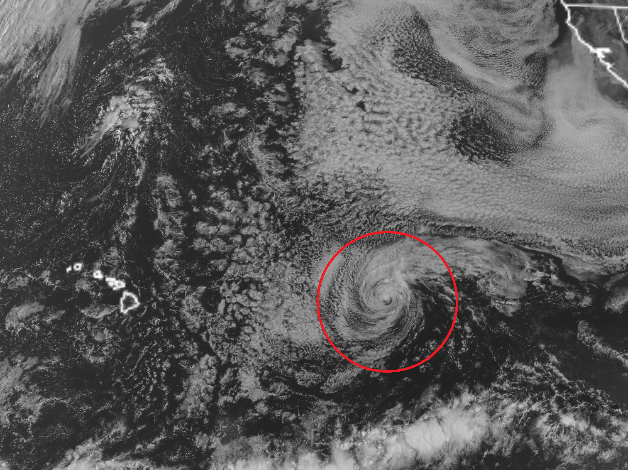
Linda is a shell of its former self now that it has moved over colder waters. Once a major annular hurricane, Linda is now a weakening tropical storm. By Saturday afternoon, it is forecast to become a post-tropical storm and further weaken to a post-tropical depression as it moves near or to the north of the islands of Kauai, Oahu, and Maui late Sunday through late Monday. While Linda won’t threaten the islands with storm force winds, remnant moisture could create some isolated flooding problems, especially on the east facing sides of all of the Hawaiian Islands. While now advisory is out for this storm in Hawaii now, that could change as Linda and its remnants approach the islands over the weekend.
