• Skip to primary navigation
  • Skip to main content
  • Skip to primary sidebar

Weatherboy

Weatherboy Weather News, Maps, RADAR, Satellite, and Forecasts.

  • Local
  • Earth Science News
  • RADAR
  • Current Warnings
  • Satellite
  • Current Maps
  • Forecast Maps
  • Video

Line of Strong to Severe T-Storms Likely Wednesday

by Weatherboy Team Meteorologist - April 20, 2021

The NAM short-duration, high-resolution computer forecast model shows a simulated RADAR view for tomorrow afternoon. It shows a line of heavier showers and storms extending from Upstate New York south to eastern North Carolina. Image: tropicaltidbits.com


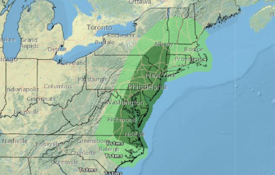
A line of strong to severe thunderstorms is likely tomorrow in the Northeast and Mid Atlantic as a robust frontal slides through. While this storm system will set the stage for yet another significant April snowstorm over portions of the Northeast, severe storms with damaging winds and hail are possible along a line from New York to North Carolina and points east.

While there could be thunderstorms anywhere in the green area, the greatest threat for severe weather on Wednesday is within the darker shaded area of this map. Image: NWS

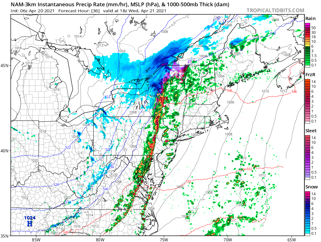
According to the National Weather Service’s Storm Prediction Center, given the linear forcing of the front, storms will likely grow upscale into a low-topped line fairly quickly. Most computer model guidance suggests this line will develop by early afternoon from central Virginia to Pennsylvania and then move quickly eastward across the I-95 corridor before continuing offshore. Given the forecast strength of the low to mid-level flow, some threat for strong to damaging winds via convective downdraft and mixing processes is apparent with the line of storms.

The nearly north-south line of storms should be centered near central Pennsylvania by 11am, eastern Pennsylvania by noon, the I-95 corridor by 2pm, and the New York/Connecticut border by 3pm.


Beyond frequent lightning and flash floods, severe thunderstorms can have wind gusts of 58 mph or higher. Winds at these speeds can knock down trees and wires, creating power outages.

Primary Sidebar

Sponsored Ad

Search

Latest News

  • Igloo Cooler Recalled Due to Amputation / Crushing Threat
  • Longtime TV Meteorologist Fired
  • Spacecraft Launched by Soviet Union in 1972 Crashed Back on Earth Today
  • Strong Tennessee Earthquake Reported by 35,000+ People
  • Updated Crash Forecast Puts Eastern U.S. on Alert from Soviet Union Spacecraft
  • Soviet Union Spacecraft Crash Zones Updated; NJ/NY/PA/MI at Increased Risk
  • Over 2,000 People Report Shaking from Virginia Earthquake
  • Morning Earthquake Strikes Heart of New Madrid Seismic Zone in Missouri Today
About | Careers | Contact | Contests
Terms | Privacy | Ad Choices
Weatherboy is a (R) Registered Trademark of isarithm LLC, All Rights Reserved.
All content herein is Copyright by Isarithm LLC 1997-2022