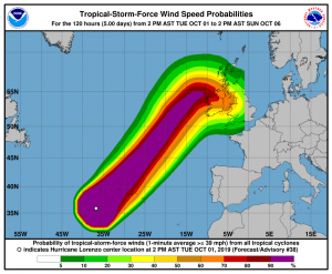
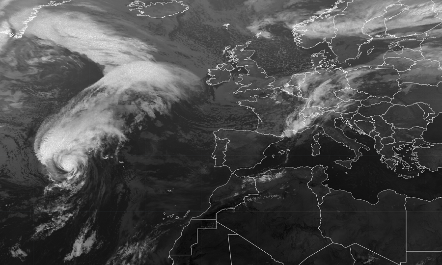
Massive hurricane Lorenzo is chugging along in the North Atlantic; it is expected to pass near the western Azores late tonight or early tomorrow. From there, it is expected to move north and east towards Europe, where tropical storm force conditions will be likely in Ireland and England.
For now, a Hurricane Warning is in effect for Flores, Corvo, Faial, Pico, Sao Jorge, Graciosa, and Terceira while a Tropical Storm Warning is in effect for Sao Miguel and Santa Maria. A Hurricane Warning means that hurricane conditions are expected somewhere within the warning area. Preparations to protect life and property should be rushed to completion. A Tropical Storm Warning means that tropical storm conditions are expected somewhere within the warning area.
In the latest advisory from the National Hurricane Center (NHC) in Miami, Florida, the center of Hurricane Lorenzo was located near latitude 37.8 North, longitude 34.3 West. Lorenzo is moving toward the northeast near 32 mph. A northeastward motion at an even faster forward speed is expected through Thursday and then slow down and turn eastward by Thursday night.

The huge storm is still packing quite the punch. Maximum sustained winds are near 100 mph with higher gusts. Only slow weakening is expected during the next 48 hours. Hurricane-force winds extend outward up to 90 miles (150 km) from the center and tropical-storm-force
winds extend outward up to 345 miles. As such, the wind field of damaging winds is roughly the distance from Chicago’s O’Hare Airport to Newark’s Liberty Airport. The estimated minimum central pressure is 960 mb or 28.35 inches.
Hurricane conditions are expected within the hurricane warning area early Wednesday morning, with tropical storm conditions beginning tonight. Tropical storm conditions are expected in the tropical storm warning area by early Wednesday. Lorenzo is expected to produce total rain accumulations of 1 to 2 inches (25 to 50 mm) over the western Azores and up to 1 inch (25 mm) over the central Azores Tuesday and Wednesday.
In addition to smashing into the Azores, significant swells generated by Lorenzo have spread across much of the North Atlantic basin, and are affecting the east coast of the United States, Atlantic Canada, the Bahamas, portions of the Greater and Lesser Antilles, the Azores, and portions of the coast of Europe. These swells are likely to cause life-threatening surf and rip current conditions.
Residents of Ireland and England should begin making preparations for tropical storm force winds there by the weekend.
