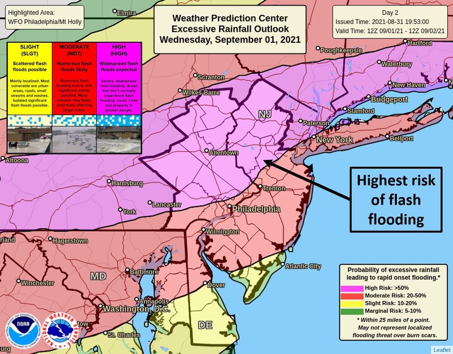
The remnants of Major Hurricane Ida will blow through portions of the Mid Atlantic tomorrow, bringing very heavy, flooding rains and the threat of scattered tornadoes and destructive wind gusts.
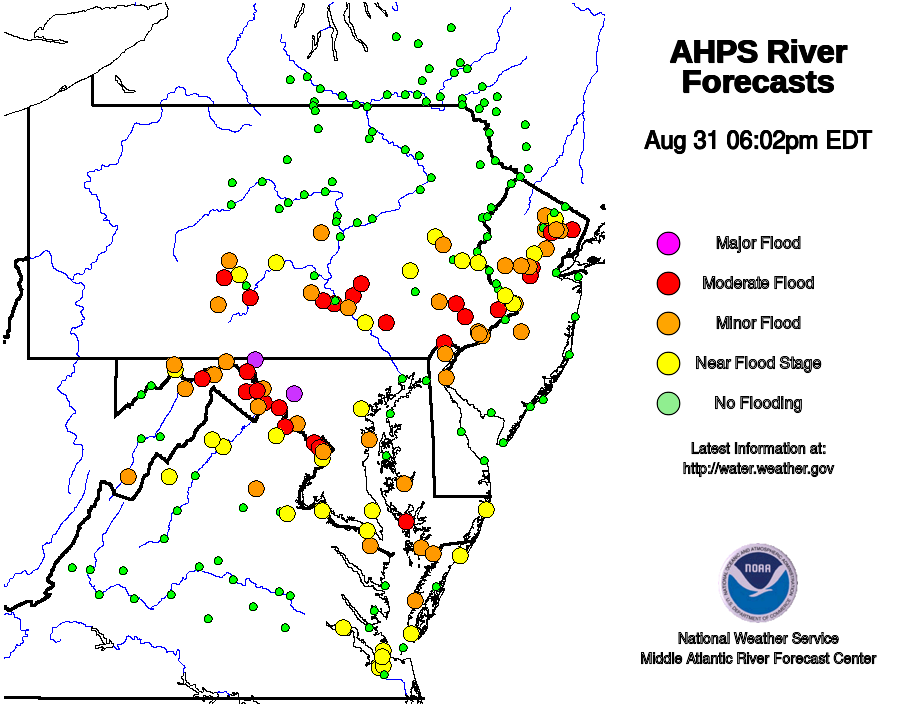
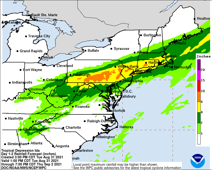
With many communities still saturated from last week’s Hurricane Henri, area soil, rivers, and streams cannot absorb much more water; as such, more flooding than usual is likely to occur as this very heavy rain moves through. The heaviest rain will be over central and eastern Pennsylvania, where 4-8″ or more of rain is likely to fall. With some rain falling over short periods of time, flood waters will likely rise rapidly, creating life-threatening flash flood conditions with little notice. The National Weather Service warns people to stay high & dry tomorrow away from floods, adding, “Turn around, don’t drown! Never drive through flood waters.”
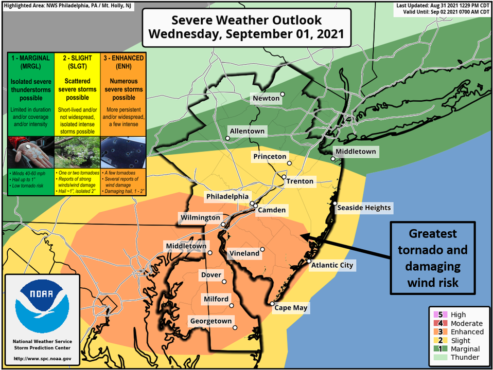
In addition to heavy rain, there is also an elevated risk of tornadoes. The greatest risk of tornadoes will be over southern New Jersey, southeastern Pennsylvania, the eastern half of Maryland, most of Delaware, and northeastern Virginia. The Washington, DC and Baltimore, MD metro regions are included in this elevated tornado risk.
Overnight tonight, precipitation chances will gradually increase from southwest to northeast across the Mid Atlantic as isentropic ascent increases in association with Ida’s warm front aloft, and lead shortwave energy moves toward the region. Atmospheric conditions will allow for a few stronger and/or more organized storm clusters over portions of Delmarva, with the main threat being gusty winds. Scattered tornadoes cannot be ruled out. Although rainfall accumulations with the late night/early morning rainfall should generally be a half an inch
or less over most areas, the heaviest rain arrives late Wednesday into early Thursday.
The National Weather Service says, “Synoptically, this will be an impressive evolution as tropical and mid-latitude meteorology collide. The remnants of Ida are tracking steadily northeastward through the Tennessee Valley, and its cloud pattern remains well-defined on satellite. The most prominent feature of this setup is the strong upper jet streak which will build into northern New England on Wednesday. Ida’s remnants will track straight into its right entrance region, where large scale upper divergence is maximized.”
Moving into this impressive atmospheric set-up, Ida’s remnants will re-intensify into a highly dynamic, baroclinic low, but still with abundant tropical moisture. The set-up will also be “providing the necessary instability for convection to grow vertically enough to be dangerous,” the National Weather Service warns, describing the growing threat of tornadic cells in the Mid Atlantic later tomorrow. Several tornadoes, including a chance for a strong tornado, would be possible especially over southern New Jersey and Delmarva, with the risk decreasing to the north. Some convectively enhanced damaging straight line wind gusts are also possible throughout the broader area being impacted by this storm.
As the system pulls away, dry weather should overspread for most of the day on Thursday, with a steady north/northeast breeze on the back side. Thursday afternoon temperatures will rise into the low to mid 70’s, with dry north winds helping to dry things out after the flooding rains. Thursday night will be dry and cool too, setting the stage for a nice end to the week on Friday.
