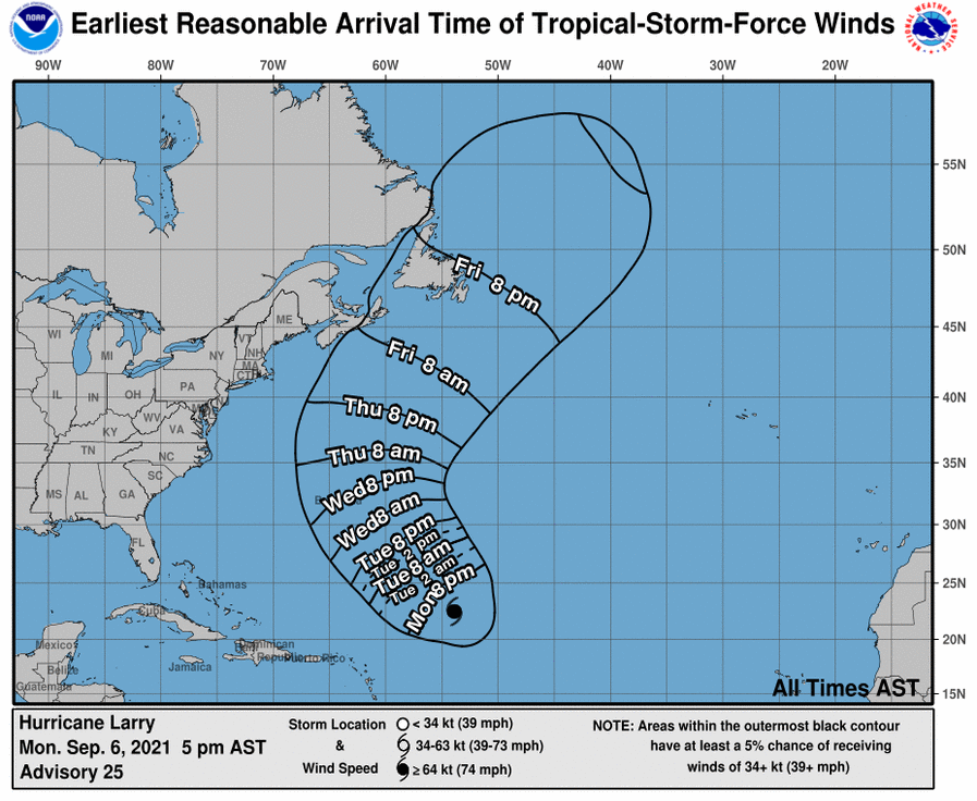
Major Hurricane Larry continues to spin about over the open waters of the Atlantic Ocean; dangerous surf and rip currents will begin to arrive from the storm onto the East Coast beginning tomorrow.
A NOAA hurricane hunter aircraft doing a research mission into Larry found the storm is slightly stronger than it was before.
As of the latest advisory from the National Hurricane Center, Larry is located at 22.5N 53.9W which is roughly 950 miles southeast of Bermuda. With maximum sustained winds of 125 mph, Larry is moving to the northwest at 10 mph. Minimum central pressure is estimated to be 956 mb or 28.23″.
Larry is forecast to continue to head northwest through Wednesday, followed by a turn to the north-northwest and north on Thursday. With 125 mph winds, Larry is a Major Category 3 hurricane on the Saffir-Simpson hurricane wind scale. According to the National Hurricane Center, some fluctuations in intensity are expected during the next couple days, with gradual weakening expected at the end of the week.
Swells generated by Larry will continue to affect the Lesser Antilles, portions of the Greater Antilles, and the Bahamas through Tuesday, and Bermuda through late this week. Significant swells should reach the east coast of the United States and Atlantic Canada by midweek and continue affecting these shores through the end of the week. According to the National Hurricane Center, these swells are likely to cause life-threatening surf and rip current conditions up and down much of the coast.
Larry is forecast to approach Bermuda as a large and powerful hurricane, bringing the risk of strong winds, heavy rain, and coastal flooding there by the middle of the week. The National Hurricane Center says it is still too soon to determine the magnitude of Larry’s impacts on Bermuda, but people there are encouraged to monitor for ongoing updates should tropical storm and/or hurricane watches be issued for the island.