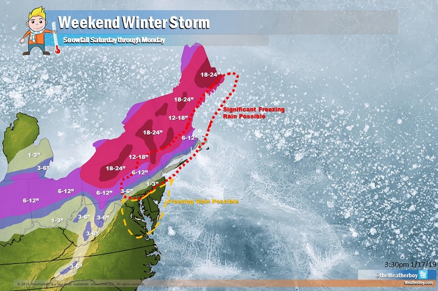
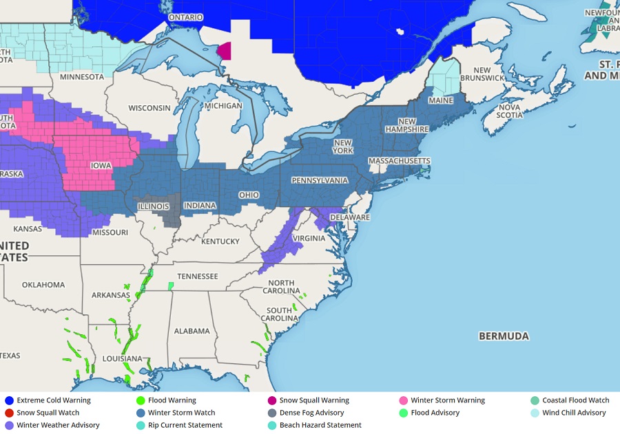
A major winter storm will blast through the northeastern United States this weekend, dumping upwards of 2 feet of snow on some areas while bringing accumulating freezing rain to other areas. Another winter storm is likely behind it, and that second system could bring more snow further south into the Mid Atlantic during the new week. The threat of heavy snow and ice has prompted the National Weather Service to issue Winter Storm Watches for New York City, portions of New Jersey, Pennsylvania, Ohio, Indiana, Illinois, Vermont, New Hampshire, Upstate New York, Rhode Island, Connecticut, Massachusetts, and Maine.
A split flow in the atmosphere will prevail over the Mid Atlantic tomorrow as a southern stream trough moves northeast into the Ohio Valley while a northern stream trough pivots southeast through Ontario, Canada. These two converging mid-level features will set the stage for a major winter storm in the northeast from Saturday into early Sunday. The biggest impacts from this storm will come on Sunday. At this time, a surface low is forecast to track northeast from the Ohio Valley on Saturday, passing near or over the Philadelphia metro area by Sunday morning. Increasing synoptic ascent ahead of the upper wave will begin to generate precipitation over western and central New York and Pennsylvania by Saturday afternoon with precipitation becoming more widespread and intense by Saturday evening. Residual cold air will likely initiate precipitation as snow in most locations on the northwest side of I-95, however the transition to rain from south to north will begin in earnest as the low-level warm front and heaviest precipitation begin to push through Saturday night.
North of this rain/snow line, which will establish itself north and west of the I-95 corridor, snow will fall, heavy at times, with very heavy accumulations expected. Widespread foot or more snowfall accumulations are expected over interior New England. Some portions of New England could see upwards of 2 feet of fresh snow from this storm system. Further south, a complicated thermal profile in the atmosphere will produced a variety of precipitation types. For places like the Lehigh Valley, portions of northern New Jersey, the New York City metro area, and south coastal New England into the Boston area, sleet and freezing rain could be significant, with ice accumulating more than 0.1-0.25″. Combined with windy conditions, power outages could be extensive as ice-covered wires can’t handle the load of both ice and wind. South of there, along and south of I-95 from New York City south, heavy rain could fall which could create isolated flooding issues. 1.5-2.5″ of rain could fall which could create flooding concerns in southern New Jersey, south eastern Pennsylvania, and Delaware.
The potent cold front will begin to push through the region from West to East on Sunday morning behind the departing surface low. This will change precipitation back over to snow in New England and perhaps over to sleet or freezing rain elsewhere in the Mid Atlantic prior to a complete changeover to plain snow. There is also a threat of a flash freeze as temperatures plunge on Sunday: wet surfaces, especially on Long Island, New Jersey, southeastern Pennsylvania, Delaware, and eastern Maryland could quickly freeze as temperatures dive.
Sunday night will be very cold throughout the region with sub-zero wind chills expected over a widespread area.
Monday will feature very cold and windy conditions with lingering snow flurries over far northern New England as the storm moves into Atlantic Canada. Northwest winds, gusting 20-30mph at times, will keep conditions very cold as far south as southern Pennsylvania and New Jersey.
Eyes will then be on the next system expected to impact this same area during the middle part of the new week; with colder air to work with, the potential exists for more snow more south in places like Philadelphia and New York City. Once the weekend storm exits, the weather pattern can be better assessed to understand how the next system will evolve.
