• Skip to primary navigation
  • Skip to main content
  • Skip to primary sidebar

Weatherboy

Weatherboy Weather News, Maps, RADAR, Satellite, and Forecasts.

  • Local
  • Earth Science News
  • RADAR
  • Current Warnings
  • Satellite
  • Current Maps
  • Forecast Maps
  • Video

Massive, Catastrophic Volcanic Eruption Possible Any Minute in Iceland

by Weatherboy Team Meteorologist - November 13, 2023

Thousands of earthquakes have struck southwestern Iceland in recent days and it is now believed lava will break through the surface at any time inside a populated town. Image: USGS


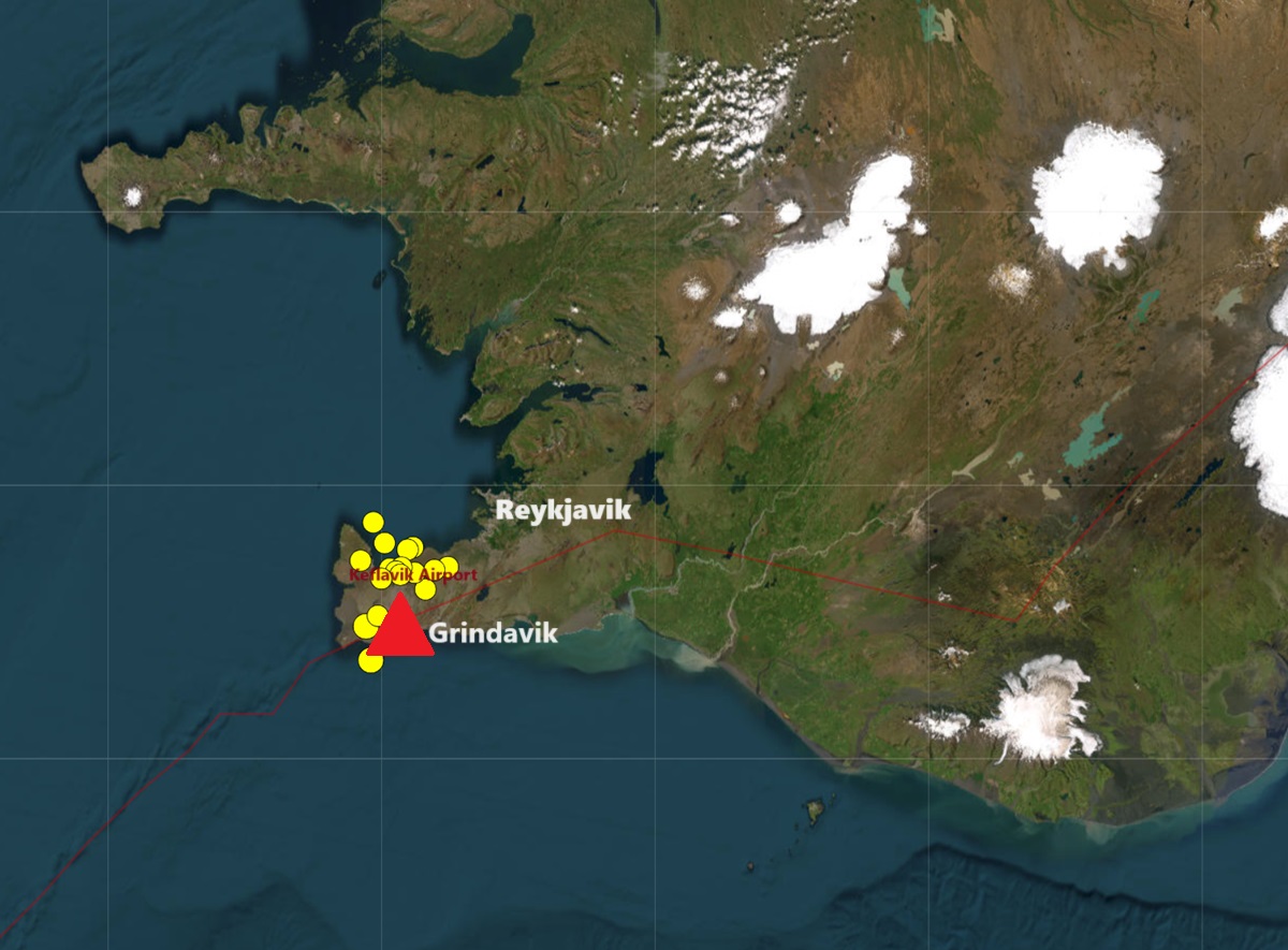
A massive, catastrophic volcanic eruption is possible any minute now in Iceland just outside of the capital city of Reykjavik in the heart of the town of Grindavik, where shocking video shows the ground caving in and opening up with hot steam rising from the cracks. Thousands of earthquakes have rocked the region, forcing authorities to completely evacuate the town of Grindavik over the weekend. The town  typically has a  population of 3,700.

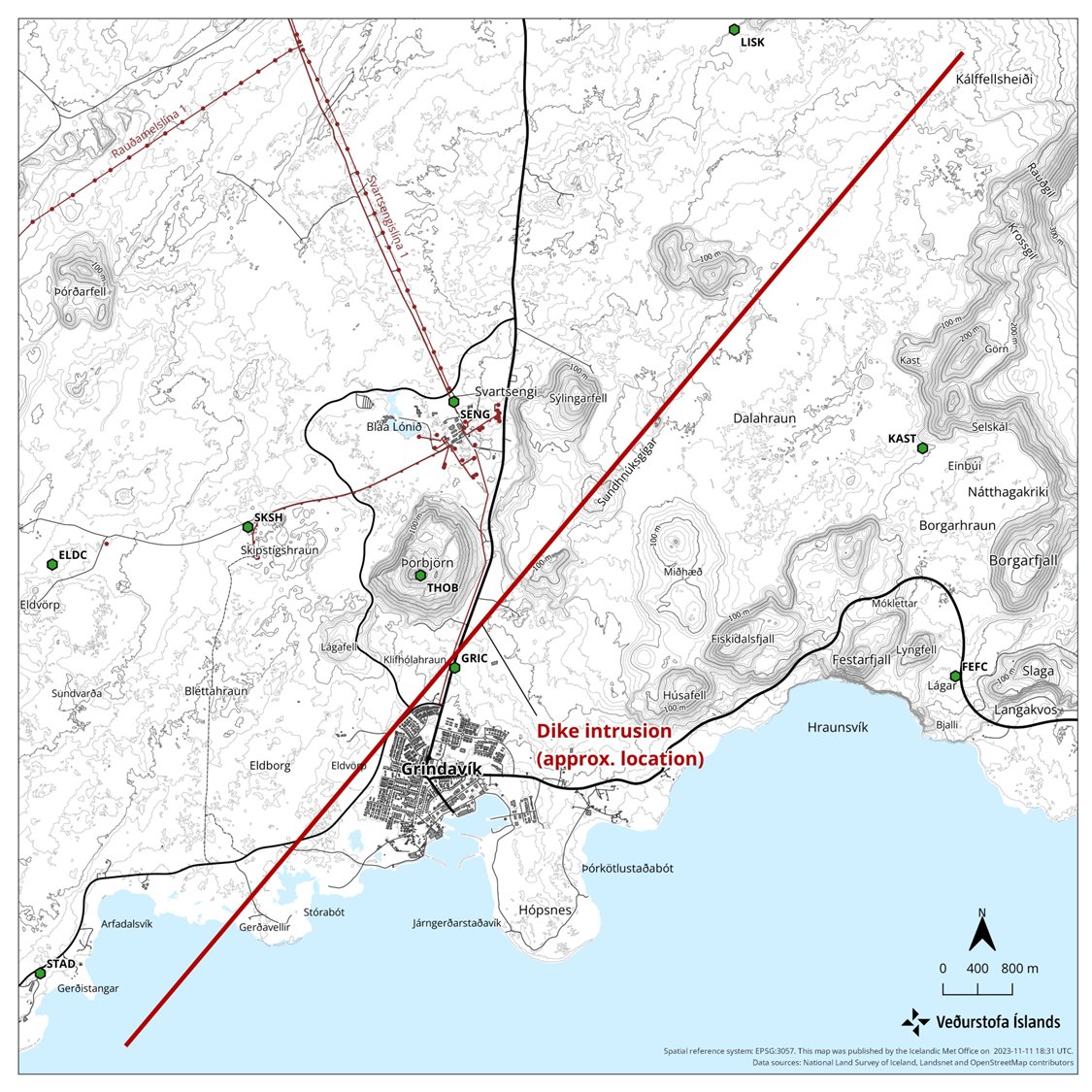
The Icelandic Met Office, responsible for both weather forecasts and volcano/earthquake information, says there’s a massive channel of magma just below the surface that can break through it at any time. Their computer models show a 9 mile long magma intrusion, located just northwest of Grindavik.

A massive magma channel exists just north and west of the downtown area; eruptive fissures are likely to break out somewhere along this line at any time. Image: Icelandic Met Office


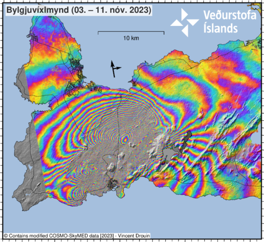
The magma has shifted the ground up/down by more than 3 feet in areas where the volcano is expected to erupt at any time in Iceland. https://t.co/uFghfN2Z5z

— the Weatherboy (@theWeatherboy) November 13, 2023


Shocking video captured earlier today shows steaming cracks opening up in the town of Grindavik. A similar incident happened in 2018 in the town of Leilani Estates on the Big Island of Hawaii. That area, located in the lower east rift zone of the Kilauea Volcano, experienced many earthquakes followed by large steaming cracks that opened in the neighborhood. Soon after, volcanic fissures erupted along a line of those cracks, inundating the community with rivers of lava and choking it with lethal levels of toxic gas. 


This is devastating to see because we know how this will play out in light of the 2018 #Kilauea #LERZ eruption in Hawaii. Our thoughts & prayers are with the people in Iceland that are about to lose everything but their lives: https://t.co/SEM3jGHQc3

— the Weatherboy (@theWeatherboy) November 13, 2023

According to the Icelandic Met Office today, seismicity along the magma intrusion continues, although the size and intensity of the activity is decreasing. Since midnight today, November 13, around 900 earthquakes have been detected. The seismic activity is concentrated on the region of the intrusion, between Sundhnukur and Grindavik at a depth of about 2–5 km.

This ascending COSMO-SkyMed (CSK) interferogram covers the time period 3-11 November and shows an extensive deformation field related to the dike intrusion that began on the afternoon of the 10 November within the Reykjanes-Svartsengi volcanic system. This CSK interferogram and the previous (spanning 2-10 November) supported the difficult decision made by Civil Protection to evacuate the town of Grindavík late Friday evening. It also enabled modelling of the dimensions of the dike intrusion (on the 11 November), which provided a median dike length of 15 km and top depth of less than 1 km below the surface. The imagery shows over 1-m of ground displacement in the western part of Grindavík, caused by the propagation of the magma intrusion. From geodetical modelling results, we infer that (as of 12 November) the greatest area of magma upwelling is sourced close to Sundhnúkur, 3.5 km north-northeast of Grindavík. Image: Icelandic Met Office
This ascending COSMO-SkyMed (CSK) interferogram covers the time period 3-11 November and shows an extensive deformation field related to the dike intrusion that began on the afternoon of the 10 November within the Reykjanes-Svartsengi volcanic system. This CSK interferogram and the previous (spanning 2-10 November) supported the difficult decision made by Civil Protection to evacuate the town of Grindavik late Friday evening. It also enabled modelling of the dimensions of the dike intrusion (on the 11 November), which provided a median dike length of 15 km and top depth of less than 1 km below the surface. The imagery shows over 1-m of ground displacement in the western part of Grindavik, caused by the propagation of the magma intrusion.  Image: Icelandic Met Office


“According to our latest estimates, the volcanic hazard assessment in and around Grindavik is unchanged from November 12,” warns the Icelandic Met Office. “All monitoring systems are being monitored closely in real-time, especially near Grindavik, for any indications of sudden change. The natural hazards monitoring team at IMO is operating at maximum surveillance while the Department of Civil Protection and Emergency Management coordinates short-term, temporary access to Grindavik today, November 13.”


 The Blue Lagoon thermal pond complex in Iceland is also in harm's way. It too was closed and evacuated. A volcanic eruption could destroy it. Image: Ivan Sabljak
The Blue Lagoon thermal pond complex in Iceland is also in harm’s way. It too was closed and evacuated. A volcanic eruption could destroy it. Image: Ivan Sabljak

Some residents are being escorted into the town to make a last minute grab of any personal effects. It is possible many structures, or perhaps even the entire town, could be destroyed by a volcanic eruption.

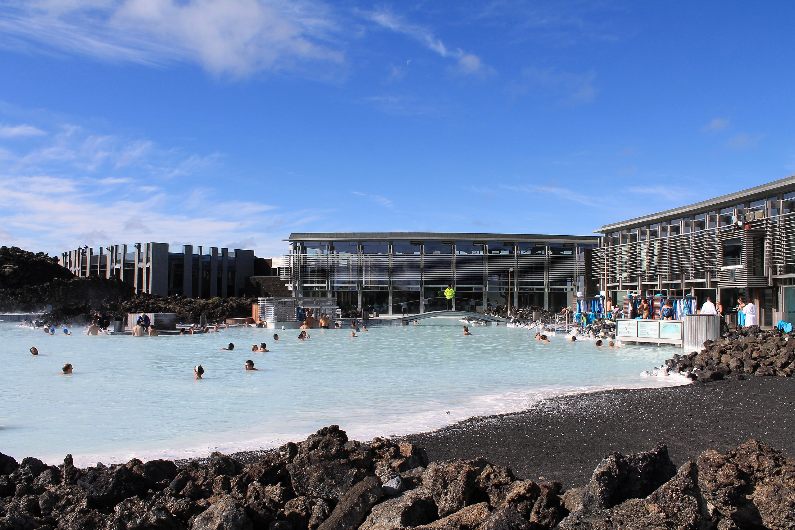
The world famous “Blue Lagoon”, a complex of thermal ponds between Reykjavik and Grindavik, has been evacuated and closed, with some roads leading to it destroyed by recent extreme earthquake activity. It is possible a volcanic eruption here could destroy this complex, a top destination for visitors exploring the landscape in Iceland.

The volcanic activity is expected south of Iceland’s major airport, Keflavik. While lava flows aren’t expected to impact the airport, earthquakes, smoke, and the possibility of some volcanic ash from the start of the eruption could impact aviation there. It could also have broader implications to trans-Atlantic aviation depending on how the eruption unfolds and how much matter is ejected into the air.

Primary Sidebar

Sponsored Ad

Search

Latest News

  • Soviet Union Spacecraft Crash Zones Updated; NJ/NY/PA/MI at Increased Risk
  • Over 2,000 People Report Shaking from Virginia Earthquake
  • Morning Earthquake Strikes Heart of New Madrid Seismic Zone in Missouri Today
  • New York TV Weatherman Back After Brain Injury
  • NASA Monitoring Significant Magnetic Anomaly over Atlantic
  • Out of Control Soviet Union Spacecraft Could Crash Into Your House This Week
  • Elevated Tornado Threat in New Jersey, Pennsylvania, and New York
  • Significant Severe Weather Outbreak Likely Today
About | Careers | Contact | Contests
Terms | Privacy | Ad Choices
Weatherboy is a (R) Registered Trademark of isarithm LLC, All Rights Reserved.
All content herein is Copyright by Isarithm LLC 1997-2022