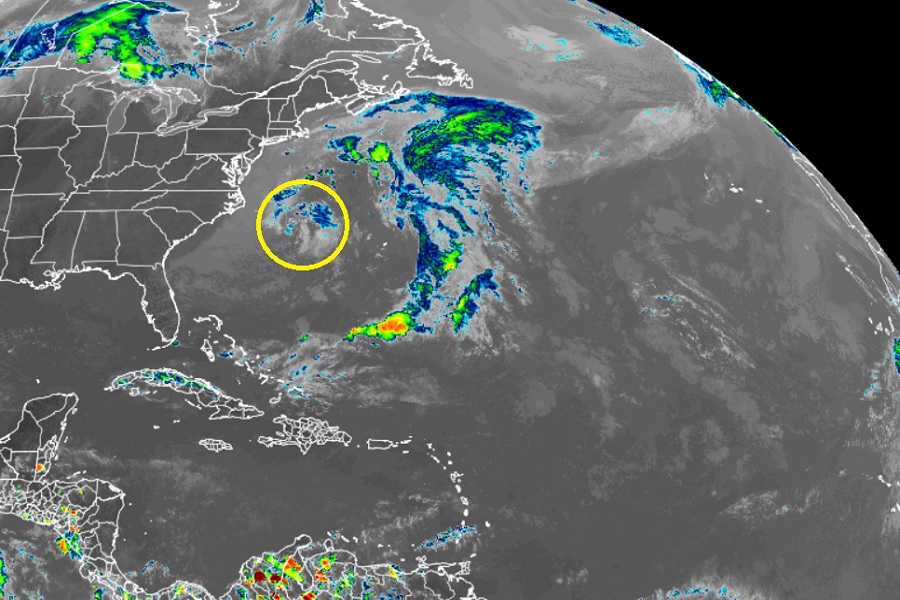
Meteorologists continue to monitor a weather system currently located off the central Mid Atlantic Coast for signs of any tropical development. A disturbance moving across the Atlantic is also being watched. Fortunately, while computer forecast guidance was initially bullish on the idea that some tropical cyclone organization could occur with either system, that looks highly unlikely for both at this time.
The first and closest system to the U.S. East Coast is an area of low pressure responsible for heavy rain and strong winds over the Mid Atlantic on the weekend. The same system led to exceptionally rocky seas off the Jersey Shore where cruise ships Oasis of the Seas by Royal Caribbean and Joy from Norwegian Cruise Lines were sailing. Cruisers took to social media to share their experiences with high waves, significant rocking, and items falling and flying about in the inclement weather.
While that coastal storm meanders off the coast, computer guidance this weekend suggested it could take on tropical cyclone characteristics and perhaps become a tropical storm by the end of the week. Not only did guidance suggested development, but it also projected a possible landfall along the U.S. East Coast as a named tropical storm. At this time, forecast guidance, including the latest American GFS and European ECMWF forecast models, do not suggest such development will occur at all. But they do forecast the system to continue to meander off the East Coast, eventually bringing rain and thunderstorms to much of the U.S. East Coast again later this week and into the weekend.
Another system that caught meteorologists’ eyes is over the eastern Atlantic. According to the National Hurricane Center’s latest Atlantic Tropical Weather Discussion, an eastern Atlantic tropical wave is along 22W, from the equator to 13N. While it looked intriguing yesterday, the National Hurricane Center reports that “convection has weakened steadily over the last 24 hours” while adding that the “latest satellite imagery shows an area of scattered moderate convection east of the wave from the equator to 11N between the coast of Africa and the wave axis.” For now, convection is weak and isolated west of the wave and immediate development is not expected with this system.
Elsewhere in the Atlantic Hurricane Basin, conditions are quiet with no signs of any tropical development anywhere.
The 2022 Atlantic Hurricane Season officially kicks off on June 1 and runs through to the end of November. While the season is officially less than 3 weeks away, tropical cyclones occasionally do form in the off-season including in May.