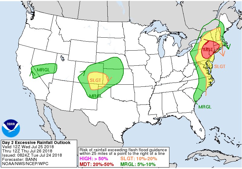
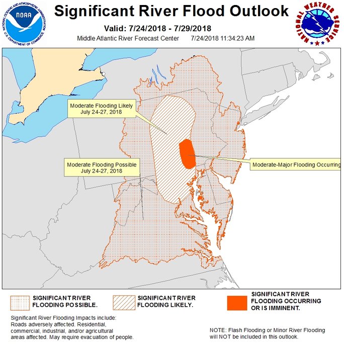
With more than a foot of rain falling in portions of the Mid Atlantic since Saturday, it appears the flooding problems have only just begun, with more heavy rain likely today into the next 36-48 hours. Atmospheric dynamics will allow the focus area of the heaviest rainfall to shift east tomorrow, shifting from a focus on central Pennsylvania and Maryland to northeast Pennsylvania, northern New Jersey, southeastern New York. western Massachusetts, and Connecticut. Flooding rains are possible in this region again, with no sign to the wet weather pattern ending anytime soon.
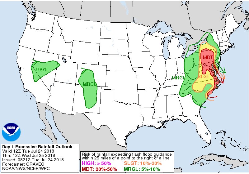
Responsible for these heavy rains is a deep upper trough which remains along the East Coast through the end of the week, with several waves of low pressure bringing rain to the East Coast over time. A cold front will move across the northeast late Thursday, followed by another one on Friday, with another low pressure system forecast to impact the eastern U.S. sometime next weekend once again. According to the National Weather Service’s Weather Prediction Center, “there is not a lot of changes to the large scale flow with a stream of much above average precipitable water values persisting in the deep layered southerly flow to the east of the elongated upper trough.” They added that there will be “periods of enhanced precipitation likely in the deep layered southerly flow with training possible in a south to north direction. Similar to previous days, confidence not great with details of where and when this training will occur.” Training is the meteorological process where rain showers or thunderstorms redevelop in the same area over and over, soaking a localized area with heavy, repeating rain.
On Wednesday, the deep upper trough west of the Appalachians will finally begins to move east while an air mass abundant in tropical moisture slides with it. Scattered thunderstorms with gusty winds are possible as things shift east somewhat, but the main issue will continue to be the heavy rain. Flooding and flash flooding will be possible, especially in training of storms, which could happen as surface low pressure lifts through the northeast late in the day and during the evening on Wednesday.
A cold front is forecast to swings through the northeast on Thursday; with abundant low level moisture still in place, areas of heavy rain will fall once again. A strong shortwave associated with the upper trough will pass through the Mid Atlantic in the afternoon, resulting in scattered showers and thunderstorms. While it won’t be a full-day wash-out, areas that do see showers and storms will be soaked by very heavy, slow moving cells. It is these slow moving cells and training cells that will produce flash flood conditions in localized areas.
