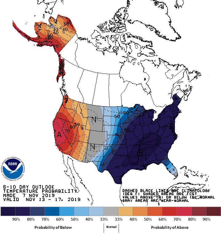
The eastern half of the United States will be much colder than usual for the middle of November with 80% or greater confidence of such cold arriving. Meanwhile, it is likely California and southern Alaska will be warmer than usual. It is rare for all of the U.S. to be above or below normal at any given point; generally, one half experiences one extreme while the other half experiences the other kind.
According to the National Weather Service’s Climate Prediction Center (CPC), below normal temperatures are favored over most of the central and eastern continental United States while above normal temperatures are likely over California and Alaska underneath forecast positive 500-hPa height anomalies and above normal sea surface temperatures nearby.
Cold air will also be joined with moisture in the east which could set the stage for more early season snow. According to the CPC, forecast shortwave troughs within the cyclonic flow aloft will enhance odds for above normal precipitation along the East Coast. A wave of low pressure and a slowing cold front increase chances for above normal precipitation across parts of southern Texas. Below normal precipitation is favored for much of the Mississippi Valley, as well as portions of the Central and Southern Plains, due to the likelihood of dry, continental air. Upslope flow tilts the odds to above normal precipitation across the northern High Plains. Ridging aloft favors below normal precipitation across much of the western continental U.S. and parts of northwestern Alaska. Above normal precipitation is likely over remainder of Alaska ahead of forecast troughing over the Aleutians.