We are closely monitoring the potential for a mid-week snow threat for portions of the Mid Atlantic this week. A very fluid and fast-moving weather pattern could bring the right ingredients together to produce accumulating snow in places that hasn’t seen much this winter: namely, New Jersey, the New York City metro area, Long Island, southeastern Pennsylvania including Philadelphia, northern Delaware, and northeastern Maryland.
Low pressure will develop over the Mid-Mississippi Valley tomorrow and head into the Great Lakes region, bringing a large area of rain with it into the northeastern United States. Where this rain collides with cold air, freezing rain and/or snow is possible over central and northern New England on Tuesday into early Wednesday.
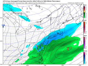
As this initial; storm exits into eastern Canada, cold air will rush into the Mid Atlantic. A new area of low pressure will form near Arkansas and head east, bringing moisture into this fresh pool of cold air. As the moisture meets the cold air, snow could break out.
Currently the American (GFS) and European (ECMWF) forecast models agree in the general idea of such a storm system forming and moving through. However, because computer forecast guidance is one of many tools meteorologists use, it is important not to trust this computer output 100% at this time. Because this overall pattern is complex and fast-moving, it is possible these ingredients won’t come together at the right place at the right time.
On Super Bowl Sunday, we saw a similar situation: while computer forecast guidance was suggesting the threat of a significant snowstorm just 4-5 days later, the storm never materialized the way forecast guidance said it would. The same may very well be true for this next storm which could impact the eastern US on Thursday.
We will continue to monitor this threat over the coming days to keep you posted.
