Global and regional forecast models used by meteorologists to aid in their weather forecasting have flip-flopped once again on the possibility of a weekend snowstorm along the East Coast this weekend. Global forecast models from Europe, known as the ECMWF, and from America, known as the GFS, now show a storm impacting the northeast. However, they differ on how the storms would evolve and what the final impacts may be.
While meteorologists have many tools at their disposal to create weather forecasts, two primary global forecast models they do use are the ECMWF from Europe and the GFS from the United States. While the models share a lot of the same initial data, they differ with how they digest that data and compute possible outcomes. One is better than the other in some scenarios, while the opposite is true in others. No model is “right” all the time. Beyond the ECMWF and GFS models, there are numerous other models from other countries, other academic institutions, and private industry that are also considered when making a forecast.
In the case of the European model, it proved to be the most accurate in its handling of the evolution of the storm that dumped more than 1′ of snow across a wide area of the northeast, including amounts in excess of 30″ in portions of New Jersey and Pennsylvania.
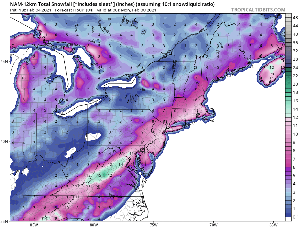
Earlier this week, the ECMWF model showed that a powerful snowstorm would return to the region this Sunday. At the time, it was the only model to show a snowstorm in the northeast. Yesterday, the ECMWF joined other guidance in showing the storm being a miss; rather than phasing energy at the coast to create a “bomb cyclone”, it showed two separate systems far apart, unable to sync-up to create another snowstorm.
But now today, not only does the ECMWF show a storm forming closer to the coast now, but it joins other regional and global guidance which suggest the same.
What changed? According to meteorologists at the National Weather Service, a mid-level shortwave that could trigger the east coast storm’s development moved closer to the southeastern coast of Alaska. While closer to the U.S. coast, the disturbance is now within the realm of the forecast domain that U.S. models, like the GFS, use. With improved sampled data being ingested into the forecast models, they should be pumping our more reliable, more accurate forecasts. It could be that the ECMWF is “seeing” this Alaskan disturbance better too, yielding to a forecast solution that favors another east coast storm.
The Mount Holly, New Jersey office of the National Weather Service said in their latest forecast discussion, “Due to the overwhelming signals, we have introduced precipitation back into the forecast for Sunday.”
With another set of data being crunched later tonight and more analysis by meteorologists being done now through tomorrow morning, a better understanding of how the atmospheric energy will come together –or not– should be known by tomorrow afternoon. But while odds dipped yesterday of a Super Bowl storm, they appear to be rebounding for now.
