Meteorologists are monitoring tropical activity in both the Atlantic and Pacific hurricane basins.
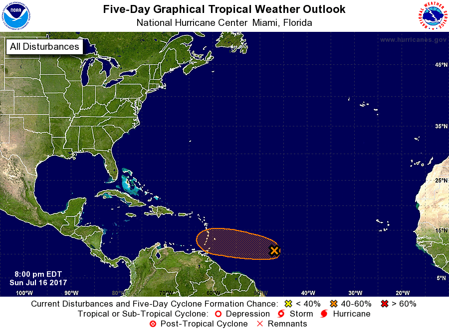
According to the latest five day outlook for the Atlantic basin from the National Hurricane Center (NHC), A weak area of low pressure located about 900 miles east-southeast of the Windward Islands continues to produce disorganized showers and thunderstorms. Environmental conditions are marginally conducive for some development of this system before it reaches the Lesser Antilles in two to three days. After that time, less favorable upper-level winds are expected to hinder additional development. An Air Force Reserve reconnaissance aircraft is scheduled to investigate the disturbance Monday afternoon, if necessary.

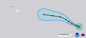
While the National Hurricane Center monitors the disturbance in the Atlantic, attention is being paid to Hurricane Fernanda in the open waters of the Pacific. Once a powerful Major Hurricane, the weaker system is expected to continue on a path to the north and west over the next 5 days over the open waters of the Eastern and Central Pacific. It is possible that in roughly a week from now, what’s left of Fernanda may impact Hawaii in someway, perhaps bringing soaking rains to the islands then.