Meteorologists at the National Hurricane Center in Miami, Florida and at the Central Pacific Hurricane Center in Honolulu, Hawaii, are closely monitoring three disturbances that could become tropical cyclones over time as they head west in the general direction of Hawaii across the Pacific. Two systems are located within the Central Pacific Hurricane Center area of responsibility while one, not far from the coast of Mexico, is under the responsibility of the National Hurricane Center. Together, they will collaborate as the systems get closer to the Aloha State.
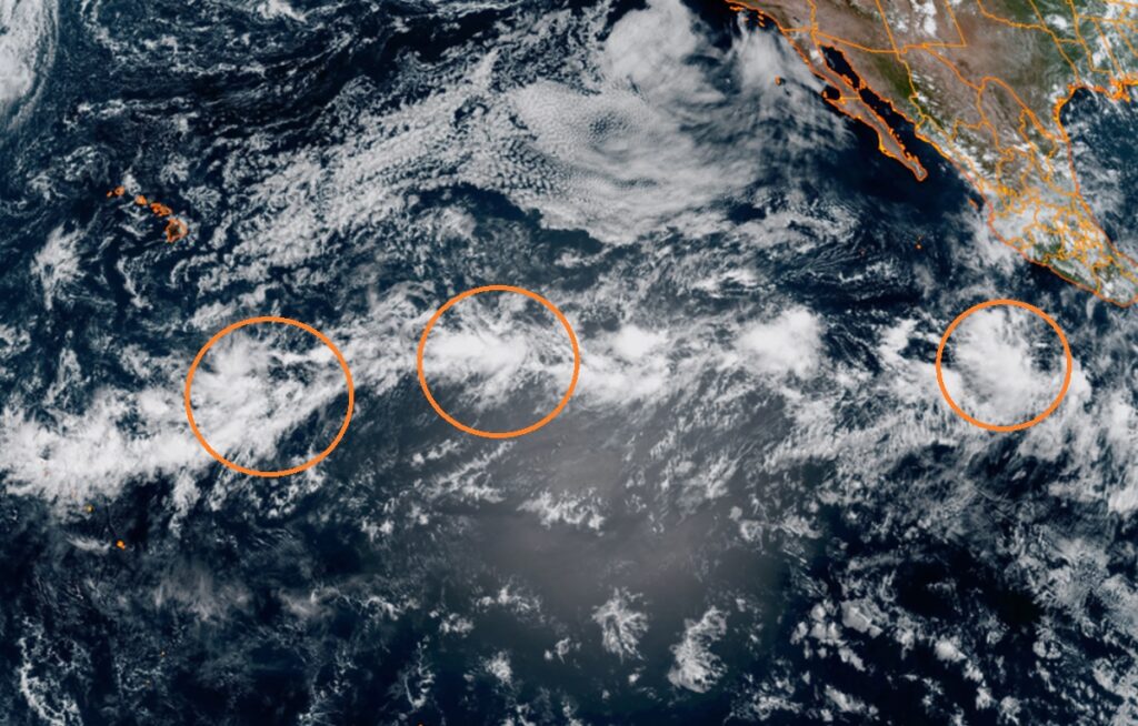
The closest of the trio also is least likely to develop into a tropical cyclone. Located about 700 miles southeast of Hilo on the Big Island of Hawaii, there’s a broad area of low pressure with disorganized showers and thunderstorms. The Central Pacific Hurricane Center says that environmental conditions appear marginally conducive for some development of this system this weekend or early next week while moving westward at about 10 mph. However, these odds are diminishing; there’s now only a 40% chance that a tropical cyclone will form here over the next 7 days.
The second system is located approximately 1350 miles east-southeast of Hilo, Hawaii. According to the Central Pacific Hurricane Center, an area of low pressure could form by early next week more than a thousand miles west-southwest of the southern tip of the Baja California peninsula. Some slow development of this system is possible, and a tropical depression could form during the middle to latter part of next week while it moves generally westward across the western portion of the East Pacific and into the Central Pacific basin. Should this system become a named tropical storm inside the Central Pacific Hurricane Basin, it would be given the Hawaiian name “Hone.” Odds of this system developing into a tropical cyclone, according to the Central Pacific Hurricane Center, is 50-50 for now.
The third system has the highest odds of growing into a tropical cyclone but it is also the farthest away of the bunch from Hawaii. Disorganized showers and thunderstorms located several hundred miles off the southwestern coast of Mexico are associated with a tropical wave. According to the National Hurricane Center, environmental conditions appear conducive for gradual development of this system during the next few days, and a tropical depression is likely to form early next week while it moves west-northwestward at about 10 mph away from the coast of Mexico. While odds of development over the next 48 hours are only 40%, they grow to a high 80% over the next 7 days.
Moisture associated with the closest systems could reach Hawaii next Monday or Tuesday, bringing the Big Island much needed rain. Yesterday, parts of the state were elevated into Severe Drought status due to a lack of rain in recent weeks.

