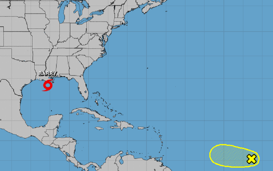
While the National Hurricane is busy tracking and issuing advisories for Barry in the Gulf of Mexico, they’re also keeping their eye on a new system in the Atlantic.
In the latest Tropical Outlook from the National Hurricane Center, they describe a small area of persistent shower and thunderstorm activity associated with a tropical wave in the central Atlantic. As of this afternoon, it is centered about 1,000 miles west-southwest of the Cabo Verde Islands. Some development of the wave is possible during the next day or so while it moves westward at 15 to 20 mph. Environmental conditions are expected to become unfavorable for development by Sunday. The National Hurricane Center says there’s only a 20% chance of formation in the next 48 hours and over the next 5 days.
Elsewhere in the Atlantic basin, there are no areas showing signs of possible tropical cyclone development over the next 5 days. The same is true for the Central Pacific Hurricane Basin, which surrounds the state of Hawaii.