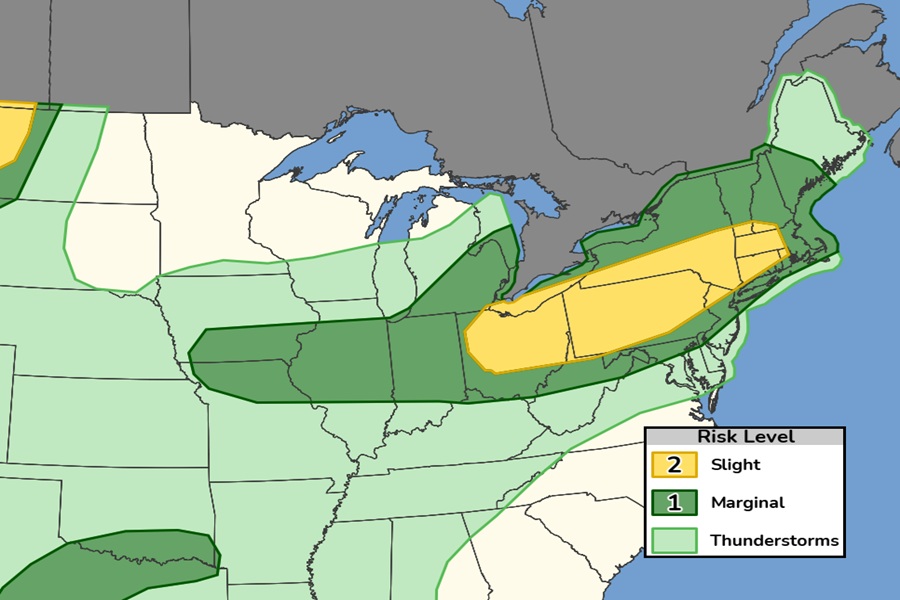
An outbreak of severe weather appears likely for portions of the northeast on Saturday. In the latest Convective Outlook from the National Weather Service’s Storm Prediction Center (SPC), they have highlighted an area stretching from Ohio through portions of Pennsylvania, New Jersey, New York, Connecticut, Rhode Island, Massachussetts, and southern portions of Vermont and New Hampshire. The greatest severe weather threat in this region will be from damaging wind gusts although large hail also can’t be ruled out. There is also an elevated risk of tornadic thunderstorms over portions of northern Ohio and the western half of Pennsylvania.

For Saturday, in general terms, scattered severe storms capable of large hail and damaging winds are possible from portions of the Great Lakes and Ohio Valley into the Northeast, and over the northern High Plains. More isolated occurrences of large hail and damaging winds are possible across parts of the southern Plains and the lower Missouri Valley into Mid Mississippi Valley.
A short-wave trough initially from James Bay into the Great Lakes Saturday morning is forecast to amplify while translating through southern Quebec and the Northeast. Associated mid/upper-level jet streaks within the base of the strengthening trough are forecast by the SPC to overspread the upper Ohio Valley through southern New England, enhancing vertical shear and forcing for ascent in those areas. At the surface, an initially diffuse cold front associated with the
Great Lakes/Northeast short-wave trough will slowly advance through the Great Lakes, northern Ohio Valley, and St. Lawrence Valley into northern New England.

According to the SPC, areas of showers and thunderstorms are expected to be ongoing Saturday morning within a broad zone of warm advection and moisture flux occurring along a westerly low-level jet. A subset of those thunderstorms are likely to persist and gradually intensify from late morning into afternoon. Additional, diurnally enhanced storms are expected to develop within preferred zones of confluence within the weakly capped warm sector, which will destabilize from west-to-east over the course of the day. The SPC says the potential exists for organized storm modes, including bowing line segments and supercells capable of swaths of wind damage and large hail during the afternoon and evening hours.
The greatest supercell potential is expected to evolve across the upper Ohio Valley, where the large hail is most probable, along with the threat for a brief tornado or two.
