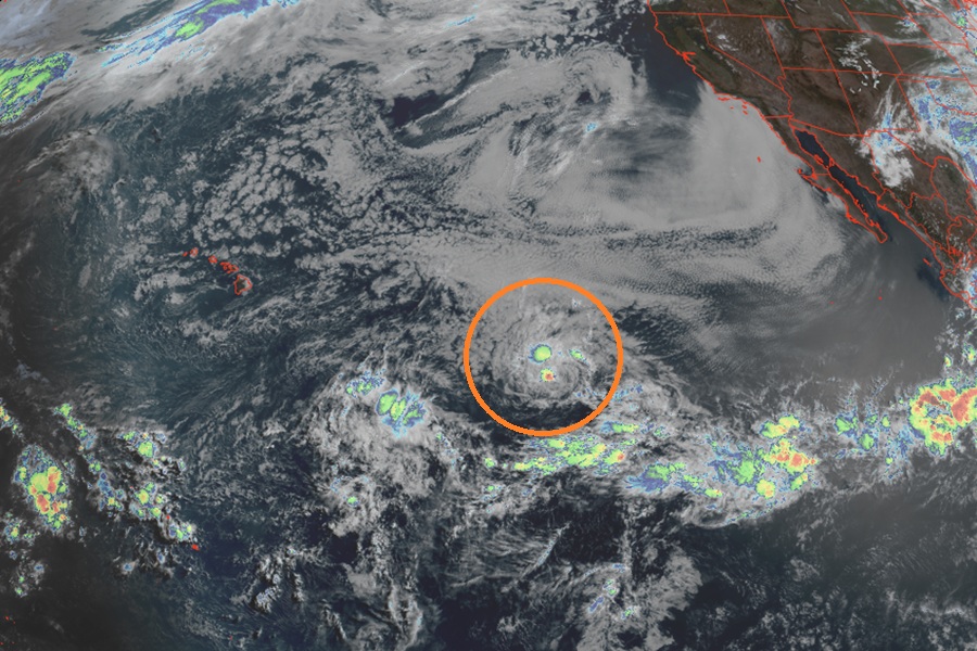
Tropical Storm Amanda appears like a mess on the latest weather satellite imagery, clinging on to a limited core of thunderstorms near its center of circulation. The National Hurricane Center doesn’t believe much will become of this storm, with a gradual weakening trend in their official forecast over the coming days and projecting it’ll become a post-tropical remnant low by early next week.
According to the National Hurricane Center (NHC), convection associated with Amanda has weakened over the past several hours. Diurnal pulses of convection are expected over the next couple of days, which should allow Amanda to maintain tropical cyclone status. However, the NHC says the storm will encounter drier mid-level air and increasing upper-level convergence over the next 36-48 hours. Because of this, slow weakening is expected due to the increasingly hostile environmental conditions, and Amanda is forecast to become a post-tropical remnant low by late Sunday or early Monday.
For now, Amanda is roughly 1,300 miles east-southeast of Hilo, Hawaii and about 1,695 miles west-southwest of the southern tip of Baja California. Maximum sustained winds are up to 45 mph with higher gusts while the minimum central pressure is 1004 mb or 29.65″. The storm is moving due west now at 10 mph.
The NHC says a slower forward speed and turn toward the west-southwest is expected today, followed by a southwestward motion by Saturday. Gradual weakening is expected today through this weekend. Amanda is forecast to degenerate into a remnant low on Sunday or early Monday. Its remnants should continue to march west well south of Hawaii and not provide any direct or indirect impacts to the islands.
Amanda is the first named storm of the 2026 Hurricane Season in the three basins monitored by the NHC: Central Pacific, Eastern Pacific, and Atlantic. Hurricane season runs in all three basins through to the end of November.
