While the northeast is digging out today after the Blizzard Bomb bombarded the region with as much as 30″ of snow, eyes are on the next winter storm threat that will begin to take shape over the next few days over the middle of the country.
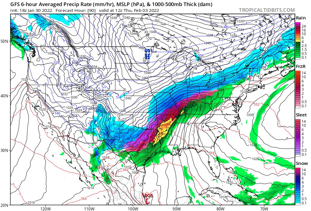
A variety of meteorological ingredients will come together to produce a potentially historic snowstorm. An upper-level low ejecting out of the Southwest will spawn numerous showers and scattered thunderstorms across southeast Texas on Monday. As that’s happening, milder air will surge up the eastern United States, bringing an end to the deep chill that set-up in the wake of yesterday’s Blizzard Bomb. On Tuesday, an approaching cold front that should bisect the country from the Great Lakes to the Southern Plains by Tuesday night. Warm southerly winds will allow for well above normal temperatures to surge from the Gulf of Mexico to the Midwest to start the workweek and then spread east for the end of the week. Meanwhile, the cold front will sink down into Texas and Oklahoma, triggering showers and storms across the Mid-Mississippi Valley as the cold air clashes with the warm air mass.
This clash will energize a significant, potentially historic, winter storm to take-shape, with heavy snow breaking out across portions of Nebraska, Oklahoma, Texas, and especially Missouri, Illinois, Indiana, and Ohio. By the time Friday arrives, 1-2 feet of snow is forecast to fall from portions of Oklahoma north and east into Ohio. Combined with strong winds around this storm system, blizzard conditions are possible here too.
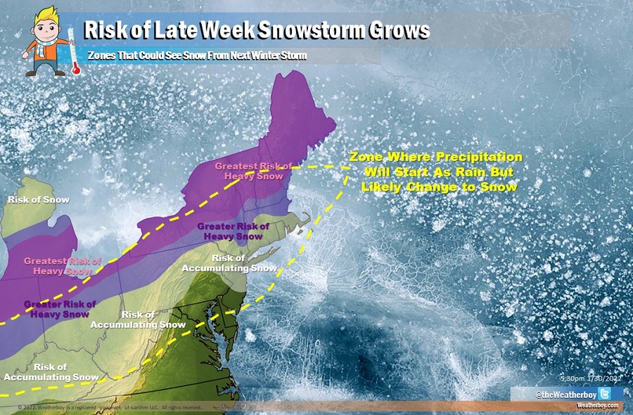
On Friday, the frontal system will reach the east coast. At first, milder air will help produce rain from southern New England south to the Gulf Coast. But as cold air wraps behind the cold front, that rain will change to snow –and the snow could be heavy at times across northwestern Pennsylvania, Upstate New York, and central and northern New England.
The greatest risk of heavy snow on Friday into Saturday across the northeast will be areas that didn’t see much of any snow from this weekend’s Blizzard Bomb. Northern Ohio, far northwestern Pennsylvania, Update New York, the northern two-thirds of Vermont and New Hampshire, and much of Maine is the zone most likely to see heavy snow again. There is a risk that significant accumulating snow will head south, but that will be dependent on how much cold air there is and how much lingering moisture is left for the storm to work with. While there’s a chance of accumulating snow as far south as Kentucky, southwestern Virginia, West Virginia, central Pennsylvania and New Jersey, and southeastern New England, there’s a better chance from the Catskills north and from Boston north at this time.
It appears there will be additional winter storm threats beyond this one too as February unfolds. Global computer forecast guidance, including both the American GFS and European ECMWF forecast models, suggest more wintry weather will impact the U.S. over the next several weeks.
