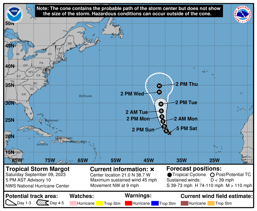
Hurricane Lee continues to spin about in the Atlantic Ocean and there still isn’t clear consensus among forecast models and the meteorologists that use them of where Lee will head in the future. More model runs suggest a landfall to the U .S. East Coast or Canadian coastline versus an out-to-sea track at this time, but it is still too early to know where exactly the storm will go. Tropical Storm Margot is also gaining strength in the Atlantic and a ridge of high pressure being squeezed by it on the east and Hurricane Lee on the west may also help steer Lee into the United States or Canada, adding to the forecasting complexity.
“It remains too soon to know what level of impacts, if any, Lee might have along the U.S. East Coast, Atlantic Canada, or Bermuda late next week, particularly since the hurricane is expected to slow down considerably over the southwestern Atlantic,” the National Hurricane Center (NHC) warns in their latest forecast discussion for the storm. “Regardless, dangerous surf and rip currents are expected along most of the U.S. East Coast beginning Sunday and Monday,” they add.
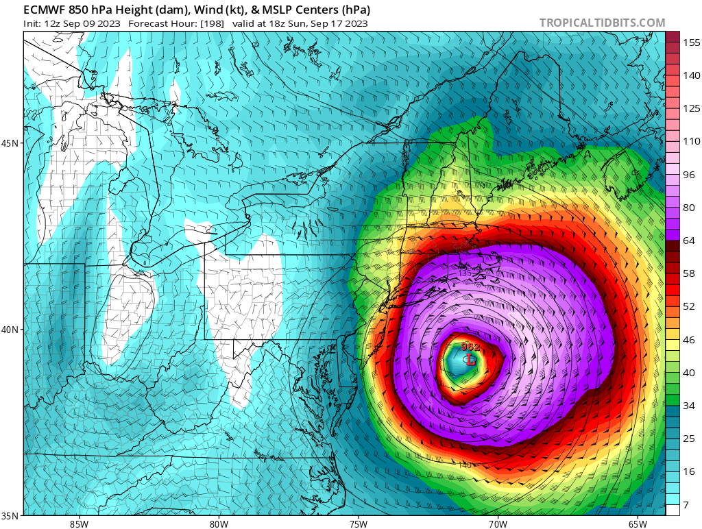
Among the forecast model giants out there are the American GFS and European ECMWF; they each have pro’s and con’s and neither is always right when it comes to their modeled solutions. In the latest runs today, the European forecast model brings the hurricane just off the Jersey Shore coast next weekend, bringing the eye of a formidable hurricane into the southeastern New England coast south of Boston. Such a scenario would bring hurricane force winds close to New York City, with destructive winds across eastern Long Island, much of Rhode Island, and southeastern Massachussetts. The American GFS has a different solution that keeps the storm off of much of the U.S. East Coast, with only southeast Massachussetts being impacted by strong winds and heavy rain. It tracks the center of Hurricane Lee into central Nova Scotia, bringing devastating impacts there. It is very possible that neither of these solutions will actually verify next weekend.
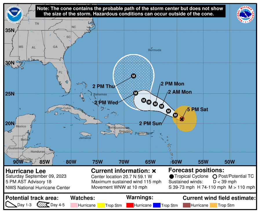
Meanwhile, the National Hurricane Center only officially forecasts 5 days out at a time. Any landfall scenario is beyond that 5 day window for now. The current NHC forecast keeps Lee on its west-northwest track north of the Leeward Islands and dramatically slows it down, and then curves it on a more north trajectory before it gets to the Bahamas. The National Hurricane Center is evaluating all of the various forecast models, but says its too soon to embrace any modeled path.
Lee has been tricky to forecast so far. While it went through a period of rapid intensification and became a category 5 hurricane on the Saffir-Simpson hurricane wind scale, it has struggled to reach forecast intensity levels since then. Despite initial forecasts of a 175 mph hurricane, the hurricane only has 115 mph winds, making it a still-major category 3 storm. The storm has also moved a bit more north than forecast, although not significantly different from what has been forecast thus far.
Even before a hurricane threatens the coast, the National Hurricane Center recommends people anywhere on the U.S. East Coast to have a Hurricane Action Plan in order. It could be possible some may need to act on such a plan later in the upcoming week.